Outline of North America
The following outline is provided as an overview of and topical guide to North America.
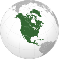
North America is a continent[1] in the Earth's Northern and Western Hemispheres.
It is bordered on the north by the Arctic Ocean, on the east by the North Atlantic Ocean, on the southeast by the Caribbean Sea, and on the south and west by the North Pacific Ocean; South America lies to the southeast.
As of July 2007, its population was estimated at nearly 524 million people.
Geography of North America Anguilla • Antigua and Barbuda • Aruba • Bahamas • Barbados • Belize • Bermuda • British Virgin Islands • Canada • Cayman Islands • Clipperton Island • Costa Rica • Cuba • Curaçao • Dominica • Dominican Republic • El Salvador • Greenland • Grenada • Guadeloupe • Guatemala • Haiti • Honduras • Jamaica • Martinique • Mexico • Montserrat • Navassa Island • Nicaragua • Panama • Puerto Rico • Saint Barthélemy • Saint Kitts and Nevis • Saint Lucia • Saint Martin • Saint Pierre and Miquelon • Saint Vincent and the Grenadines • Sint Maarten • Trinidad and Tobago • Turks and Caicos Islands • United States • United States Virgin Islands ^These three form the SSS islands that with the ABC islands comprise the Dutch Caribbean, of which *the BES islands are not direct Kingdom constituents but subsumed with the country of the Netherlands.