Tours Amphitheatre
It was built atop a small hill on the outskirts of the ancient urban area, making it safe from floods, convenient for crowds and visitors, and demonstrating the power of the city from a distance.
About a century later, this expanded amphitheatre was transformed into a fortress, with an addition of a rampart style wall, typical during the decline of Roman Empire.
Over the past decade, more in-depth studies of the topography and architecture have taken place and are changing the theories and opinions surrounding this monument.
The city of Tours (known as Caesarodunum in Roman times) was established in the valley between Loire and Cher rivers, probably during the reign of Augustus or Tiberius (between 10 BC and 30 AD).
The urban planning was such that the amphitheater had to accommodate large numbers of spectators, from within and outside the city and had to allow space for crowds around the monument.
The high ground upon which the amphitheater was built also allowed for the demonstration of wealth and power from a distance, a characteristic that was considered very important in the urban planning decisions of the Roman Empire.
Studies conducted up to the late 1970s presented an image of a monument that was relatively homogeneous in its construction, built in a single period (early second century).
The entrances were paired vomitoria assembled into large blocks with sharp joints, the piers were topped with molded capitals that support a semicircular arch.
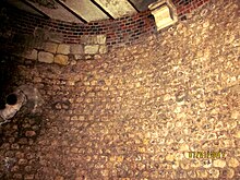
The rest of the masonry of the walls and vaults of the amphitheater, was likely built from small rubble limestone cement (opus vittatum) without inclusion of terracotta, enclosing the stone blocks in concrete.
This is based on the comparison of the architectural elements of the amphitheater of Tours and those of Amiens, Autun or Saintes, three monuments which have been precisely dated.
For example, the width and height of the main vomitoria vary significantly at the junction of two phases of work; two half-diameter reinforcements were built on either side of the entrances to increase the load bearing capacity (see Fig.
An annular wall was constructed without the use of quoin tiling and without large recycled stone blocks (from other dismantled buildings) included in its foundations.
The evidence from excavations carried out in different points of the enclosure of the castrum and systematic reviews of previous work show that outer wall was well constructed against the amphitheater and extended from its location.
Also the west, south and east vomitoria, which were outside the defended area, remained in service and may have been converted into a formal castrum entrance as was the case in Trier.
What is striking in the case of Tours is the perfectly symmetrical positioning of the amphitheater in the heart of the new town plans and the geometry of the enclosure, only disturbed by the Loire River which washed the base of the north wall.
At that time, former vomitoria, that were then mainly underground, were transformed into cellars and partitioned by walls, their length, their width and sometimes even in their height, leading to several levels of basements.
The development of the area becomes apparent, however, still with a lot of open spaces (two documents of the thirteenth century mentioned vineyards and stables).
Despite the conversion of vomitoria as basements, no further reference is made to the ancient monument as the whole area is finally slowly consumed by homes and the remains of the amphitheater were no longer visible.
It can be assumed that, like the other arenas of the Roman Empire, including Gaul, that there were gladiator fights (as was the case in Bourges) and executions of convicts (as occurred in Lyon or in Trier).
In its final state, the amphitheater of Tours was among the greatest of the Roman Empire with dimensions comparable structures of Autun, Italica (Spain), Capua (Italy) and Carthage (Tunisia); cities whose political weight and height significantly overshadowed those of Caesarodonum.
One theory was a desire for emulation among the Gallo-Roman cities, and that they were eager to show their power by building larger, higher, edifice as a civitas.
Spectacular monuments of the time were frequently offered to towns by wealthy citizens, who had financed the construction, however this practice of euergetism in Tours has not been proven thus far by any source.
Moreover, during this period of slow economic growth it is difficult to determine who had the finances necessary for this costly project and who would ultimately benefit from such an undertaking.
Examination of cadastral maps, Napoleonic (1836 A.D.) or modern is even more suggestive, as parcels of land display a radiant profile and emphasizes the layout of the amphitheater.
In fact, the height of the amphitheater was certainly much higher but the centuries have worn down a part of the step and gradually leveled the monument with the accumulation of debris at its foot.
The protective measures mentioned in references in the table apply only to the height, roofs or the decoration of the houses concerned, but not to their foundations, which are seated on the ruins of the amphitheater.
[Note 1] Similarly, the perimeter and the Cathedral area, of which the amphitheater is part, is a historic site under the Law of 2 May 1930, and by the Decree of 7 June 1944.