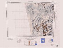
Towle Valley
[1] Towle Valley was mapped in 1957 by the New Zealand Northern Survey Party of the Commonwealth Trans-Antarctic Expedition (1956–58).
It was named by them for the USNS Private John R. Towle, an American freighter which carried a large part of the New Zealand stores south in December 1956.
The irregular, mainly ice-free heights which rise to about 2,000 metres (6,600 ft) at the south side of the head of Towle Valley.
Named by the 1976-77 Victoria University's Antarctic Expeditions (VUWAE), led by Christopher J. Burgess, after New Zealand author Maurice Shadbolt.
[4] This article incorporates public domain material from websites or documents of the United States Geological Survey.