Transantarctic Mountains
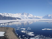
The large summits and dry valleys of the TAM are some of the few places in Antarctica not covered by ice, the highest of which rise more than 4,500 metres (14,800 ft) above sea level.
The highest mountain of the TAM is the 4,528 m (14,856 ft) high Mount Kirkpatrick in the Queen Alexandra Range.
The first crossing of the Transantarctic Mountains took place during the 1902–1904 British National Antarctic Expedition at the Ross Ice Shelf.
Much of the range remained unexplored until the late 1940s and 1950s, when missions such as Operation Highjump and the International Geophysical Year (IGY) made extensive use of aerial photography and concentrated on a thorough investigation of the entire continent.
The name "Transantarctic Mountains" was first applied to this range in a 1960 paper[2] by geologist Warren B. Hamilton, following his IGY fieldwork.
The range was uplifted during the opening of the West Antarctic Rift System to the east, beginning about 65 million years ago in the early Cenozoic, and soon after became occupied by glaciers.
The sedimentary layers include the Beacon Supergroup sandstones, siltstones, and coal deposited beginning in the Silurian period and continuing into the Jurassic.
[4] These geographic features are likely to have a significant impact on models and calculations related to ice flow through the Transantarctic Mountain region.