Transportation in Mexico City
The transport services are operated by public or private entities but all of them are regulated in the city by the Secretaría de Movilidad (SEMOVI; Secretary of Mobility).
Mexico City is served by a 225.9 km (140 mi) metro system operated by Sistema de Transporte Colectivo, which is the largest in Latin America.
Each icon was developed based on historical (characters, sites, pre-Hispanic motifs), linguistic, symbolic (glyphs) or geographic references.
The city's first bus rapid transit line, the Metrobús, began operation in June 2005, along Avenida Insurgentes.
[11] In 2014, the city launched so-called "Bus Rapid Service", with mid-sized Mercedes-Benz Boxer buses carrying 75–85 passengers[16][17] painted purple-on-white, replacing 'peseros' on certain groups of routes.
Mexico City has a cable car system to connect high-altitude areas that other means of transportation can hardly access.
Its function is to link these areas with metro stations to expedite the commute for people living in these parts of the city, which are generally characterized as lower-income.
As of May 2024, ECOBICI has reached over one-hundred million bike rides, and has 709 stations with 9,300 bicycles across an area stretching over 5 boroughs: Azcapotzalco, Benito Juárez, Coyoacán, Cuauhtémoc, and Miguel Hidalgo.
Bicycle-service users have access to several permanent dedicated bike paths/lanes/streets, including ones along Paseo de la Reforma and Avenida Chapultepec as well as one running 59 kilometers (37 miles) from Polanco to Fierro del Toro, which is located south of Cumbres del Ajusco National Park, near the Morelos state line.
A second level (where tolls are charged) of the Periférico, colloquially called the segundo piso ("second floor"), was officially opened in 2012, with sections still being completed.
In 2013 the Supervía Poniente opened, a toll road linking the new Santa Fe business district with southwestern Mexico City.
Ring roads are the Circuito Interior (inner ring), Anillo Periférico; the Circuito Exterior Mexiquense ("State of Mexico outer loop") toll road skirting the northeastern and eastern edges of the metropolitan area,[26] the Chamapa-La Venta toll road skirting the northwestern edge, and the Arco Norte completely bypassing the metropolitan area in an arc from northwest (Atlacomulco) to north (Tula, Hidalgo) to east (Puebla).
A second level (where tolls are charged) of the Periférico, colloquially called the segundo piso ("second floor"), was officially opened in 2012, with sections still being completed.
In 2013 the Supervía Poniente opened, a toll road linking the new Santa Fe business district with southwestern Mexico City.
In order to mitigate that and other problems and to raise revenue,[31] 721 parking meters (as of October 2013), have been installed in the west-central neighborhoods Lomas de Chapultepec, Condesa, Roma, Polanco and Anzures, in operation from 8 AM to 8 PM on weekdays and charging a rate of 2 pesos per 15 minutes, with offenders' cars booted, costing about 500 pesos to remove.
30 percent of the monthly 16 million-peso (as of October 2013) income from the parking-meter system (named "ecoParq") is earmarked for neighborhood improvements.
The granting of the license for all zones exclusively to a new company without experience in operating parking meters, Operadora de Estacionamientos Bicentenario, has generated controversy.
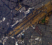
Mexico City International Airport has two terminals, which are serviced by the Aerotrén, a self-driving people mover system.