Traverse Mountains
The eastern section of the range (often called Traverse Mountain) is split up between the cities of Lehi and Draper.
The western section of the range is part of the Camp Williams National Guard Training Site.
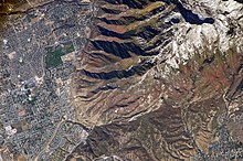
A catastrophic landslide event, perhaps triggered by an earthquake along the adjacent Wasatch Fault, displaced the Paleozoic sedimentary rocks about 16-17 kilometers (~10 miles) west to its current location.
Pseudotachylyte zones in the area, caused by intense frictional heat, mark the landslide's path.
The slide probably occurred in this area due to hydrothermal alteration caused by the Little Cottonwood intrusion that weakened the overlying rocks.