Tropical Storm Vamei
Though Vamei was officially designated as a tropical storm, its intensity is disputed; some agencies classify it as a typhoon, based on sustained winds of 120 km/h (75 mph) and the appearance of an eye.
On 19 December, a small low-level circulation was located along the northwest coastline of Borneo; at the same time a plume of cold air progressed southward through the South China Sea on the southeastern periphery of a ridge over the Far East.
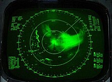
Shortly thereafter, an eye with a 39 km (24 mi) diameter became apparent on satellite imagery, along with rainbands extending southward to the opposite side of the equator.
At about 0830 UTC on 27 December, Vamei made landfall approximately 60 km (37 mi) northeast of Singapore,[2] in the southeastern portion of the Malaysian state of Johor.
[4] Initially, the Malaysian Meteorological Department (MetMalaysia) classified the cyclone as a tropical storm,[5] though it was later re-assessed as a typhoon at landfall.
[6] Vamei weakened quickly as it crossed the extreme southern portion of the Malay Peninsula, and late on 27 December, the JMA downgraded it to tropical depression status before the cyclone emerged into the Straits of Malacca.
[2] Early on 28 December, Vamei moved ashore on northeastern Sumatra, and at 06:00 UTC, the JMA classified the storm as dissipated.
[1] Vamei developed in a vortex that appears every winter along the northwest coast of Borneo and is maintained by the interaction between monsoonal winds and the local topography.
As the area in the South China Sea between Borneo and Singapore is only 665 km (413 mi) wide, a vortex needs to move slowly to develop.
[1] Four days prior to Vamei moving ashore, the Malaysian Meteorological Department (MetMalaysia) issued storm advisories for potentially affected areas.
Additionally, monsoonal moisture, influenced by the storm, produced moderate to heavy precipitation across various regions of peninsular Malaysia.

Tropical storm (39–73 mph, 63–118 km/h)
Category 1 (74–95 mph, 119–153 km/h)
Category 2 (96–110 mph, 154–177 km/h)
Category 3 (111–129 mph, 178–208 km/h)
Category 4 (130–156 mph, 209–251 km/h)
Category 5 (≥157 mph, ≥252 km/h)
Unknown