Turnstile Ridge
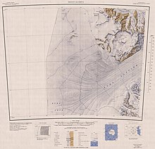
It is west of the head of the Hatherton Glacier, which forms the boundary between the Darwin Mountains and the Britannia Range, The Westhaven Nunatak is southwest of Turnstile Ridge.
[2] Many of the nearby features were named in association with Britannia by a University of Waikato (New Zealand) geological party, 1978-79, led by M.J.
A prominent nunatak, 2,240 metres (7,350 ft) high, standing 3 nautical miles (5.6 km; 3.5 mi) south of Turnstile Ridge in the northwest part of Britannia Range.
A prominent mountain, 2,470 metres (8,100 ft) high, with a level razor-back snow ridge at its highest (eastern) part, standing 2 nautical miles (3.7 km; 2.3 mi) northeast of Three Nunataks.
So named by the Darwin Glacier Party of the CTAE (1956-58), who sheltered for five days in the largely snow-free area below the north side of the summit ridge.
Three nunataks, largely ice covered, lying 2 nautical miles (3.7 km; 2.3 mi) southwest of Haven Mountain at the northwest edge of the Britannia Range.
An ice-free valley 3 nautical miles (5.6 km; 3.5 mi) southeast of Turnstile Ridge.
A rock ridge that rises over 2,000 metres (6,600 ft) high and extends from Banna Peak northeast toward the head of Hatherton Glacier.
Ice-free valley bounded eastward by Danum Platform, lying 6 nautical miles (11 km; 6.9 mi) northeast of Haven Mountain.
The valley opens northward to Hatherton Glacier, 8 nautical miles (15 km; 9.2 mi) west-northwest of Derrick Peak.
[17] This article incorporates public domain material from websites or documents of the United States Geological Survey.