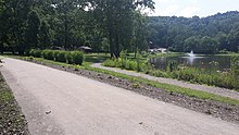
Turtle Creek (Monongahela River tributary)
Turtle Creek is a 21.1-mile-long (34.0 km)[2] tributary of the Monongahela River that is located in Allegheny and Westmoreland counties in the U.S. state of Pennsylvania.
During the mid-nineteenth century, the Pennsylvania Railroad laid tracks along the stream as part of its Main Line from Philadelphia to Pittsburgh.
[5] During the mid-eighteenth century, the Turtle Creek valley lay on the western frontier of the British colony of Pennsylvania, and much of its early written history revolved around the French and Indian War.
In 1755, the first major battle in the theater took place near the mouth of Turtle Creek at the Monongahela river, where the British General Edward Braddock was mortally wounded and his forces compelled to retreat from what became a failed expedition to capture the French Fort Duquesne.
In 1758, General John Forbes led a more formidable and ultimately successful expedition against the fort, establishing a more northerly military road which crossed Turtle Creek in what is now Murrysville.
Bouquet's description inspired the name of small stream that flows into Turtle Creek there, "Dirty Camp Run.
Andrew Carnegie's Union Railroad was laid along Turtle Creek and its tributary, Thompson Run connecting to his Edgar Thomson Steel Works in Braddock.
George Westinghouse's Interworks Railway began service in 1902, connecting his three major manufacturing facilities in the lower Turtle Creek valley.
In 1852, the Pennsylvania Railroad Company began running its main line along the left bank of the lower section of Turtle Creek.
Sometime between 1903 and 1915 the creek was further diverted to straighten the tracks of the railroad on its right bank, where the Westinghouse Interworks Railway company ran its trains.
[16] The Pennsylvania Railroad Company also diverted the flow of the creek in the Blackburn neighborhood of Trafford to create a wye (pronounced like the letter "Y") to enable its trains to switch directions there.
All American Park, a baseball and softball complex built at a former Westinghouse site in Trafford, has some fields which straddle the Allegheny/Westmoreland County border.
The Westinghouse Floodgate project was undertaken from 1937 to 1938 for the purpose of blocking similar floods from backing up into the Turtle Creek channel.
Flash floods in 1911, 1942 and 1950 all deposited rain at a rate which exceeded the capacity of Turtle Creek to drain it,[25] and, in October 1954, the remnants of Hurricane Hazel caused what was then the flood of record by attempting to discharge 12,300 cubic feet (350 m3) of water per second through a Turtle Creek channel that had a drainage capacity of only 5,100 cu ft/s (140 m3/s), overflowing its banks and causing an estimated $13 million in damages (approximately $117 million in 2023[26]).
The following year, the Turtle Creek District Flood Authority was organized to work with the Army Corps of Engineers on a massive channelization project whose design and construction continued into the next decade.
[25] For the 3.8 miles (6.1 km) downstream to the river, the channel was improved with stone and concrete walls and a similarly lined bottom, affording a 20,000 cu ft/s (570 m3/s) capacity for this more heavily developed, lowest section of the creek.
[33] The completed project begins just upstream of Puckety Drive, with a levee near the eastern edge of the Dura-Bond steel tube coating facility.
[32] At this point low flow waters are allowed into the natural Turtle Creek stream channel alongside Old William Penn Highway, while excess flow is directed underground through an additional 2,905 feet (885 m) of culvert to rejoin the meandering stream on the west side of Export.


