Typhoon Chanthu (2010)
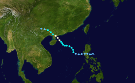
Early on July 17, the JMA reported that a tropical depression had developed about 220 km (135 mi) to the northeast of Manila, Philippines.
[3] However, as the low-level circulation center was located close to land and was not very organized, the JTWC declared that there was a poor chance of it becoming a significant tropical cyclone within 48 hours.
As a result, early the next day the JTWC issued a tropical cyclone formation alert on the depression, however they thought that further development might be hindered as it was located close to land.
[4] Whilst it moved along the southern edge of the subtropical ridge, the Depression made landfall in Aurora province at 0600 UTC,[5] before the JTWC initiated advisories later that morning, as the low-level circulation center had consolidated and poleward outflow into the tropical upper tropospheric trough had improved.
The Paltic barangay, within Dingalan, became inaccessible to rescuers after the local river topped its banks and washed out nearby slopes.
[16] In China, The Xinhua State news reported that two people were killed by walls that were blown over by strong gales.
State-run television broadcast images of large waves crashing on to the Guangdong shore, trees flattened by wind and electric poles collapsed onto streets under heavy rain.
[18] The southern Chinese provinces of Guangdong and Hainan braced themselves, ahead of Typhoon Chanthu's expected landfall.
[19] In all, 9 people were killed in South China, and total economic losses were counted to be CNY 5.54 billion (US$817.7 million).
In the Bắc Giang province, 10 communes were isolated and 44,100 hectares (170 sq mi) of destroyed rice crops.
Tropical storm (39–73 mph, 63–118 km/h)
Category 1 (74–95 mph, 119–153 km/h)
Category 2 (96–110 mph, 154–177 km/h)
Category 3 (111–129 mph, 178–208 km/h)
Category 4 (130–156 mph, 209–251 km/h)
Category 5 (≥157 mph, ≥252 km/h)
Unknown