Typhoon Sally (1964)
Sally continued to intensify on its west-northwestward trek, and reached its peak strength on September 7 over the Philippine Sea.
A person drowned from the typhoon's onslaught, while the naval station at San Vicente and the adjoining village sustained an estimated $500,000 in damage.
Due to fears of a repeat of Typhoon Ruby, which struck the region less than a week prior, 10,000 people were evacuated ahead of the storm.
Sally produced wind gusts as strong as 154 km/h (96 mph) and dropped torrential rain that damaged homes and crops and induced one landslide that killed nine people.
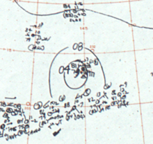
[2] The next day, observations from ships in the region indicated that the system organized into a tropical depression approximately 240 km (150 mi) southwest of Eniwetok Atoll.
Aircraft reconnaissance investigating the nascent cyclone later that day determined that Sally reached tropical storm strength while located roughly 320 km (200 mi) northeast of Chuuk State.
[4][2] The Japan Meteorological Agency (JMA) estimated that Sally's central barometric pressure decreased to 895 hPa (mbar; 26.43 inHg).
[6] The center of Sally then moved near the northern Philippines, passing 40 km (25 mi) north of Aparri on September 9.
[7] The JTWC estimated that Sally's one-minute sustained winds decreased during this period, and continued to diminish further as the typhoon tracked across the South China Sea.
[4] At 15:00 UTC on September 10, Sally made landfall on the People's Republic of China east of Hong Kong with one-minute sustained winds of 155 km/h (96 mph).
[3][2][4] The remnants of Sally continued towards South Korea and Japan before they were last noted on September 16 over southern Kamchatka.
[3] On September 4, Sally was forecast by the JTWC to bring heavy surf and sustained winds of 75–85 km/h (47–53 mph) to Guam, accompanied by higher gusts.
[14] The storm brought strong winds and heavy rains to areas north of Manila,[7] resulting in substantial crop and property damage.
[16] The United States Agency for International Development described Sally as having done "considerable damage" in northern Luzon, but could not assess the total number of casualties.
[17] The naval station at San Vicente and the adjoining village sustained an estimated $500,000 in damage; one person drowned and two thousand others were left in need of food and clothing.
[19] Following Typhoon Ruby's impacts in Hong Kong earlier in September, 3,400 workers were enlisted to clear the colony's drainage systems in preparation for Sally.
[20] While the center of the storm was forecast to miss Hong Kong, Sally's peripheral winds were expected to be comparable to Ruby's.
[21] A spokesperson for the Royal Observatory in Hong Kong called Sally "the biggest [typhoon] in living memory" while the storm was centered 275 km (171 mi) to the southeast.
[22][23] The Hong Kong government noted that cranes, fences, scaffolding, and signboards loosened in Ruby's passage became hazardous with Sally's potential impacts.
Riot police were deployed for crowd control as people began to flee Hong Kong's islands for the mainland en masse.

Tropical storm (39–73 mph, 63–118 km/h)
Category 1 (74–95 mph, 119–153 km/h)
Category 2 (96–110 mph, 154–177 km/h)
Category 3 (111–129 mph, 178–208 km/h)
Category 4 (130–156 mph, 209–251 km/h)
Category 5 (≥157 mph, ≥252 km/h)
Unknown