U.S. Route 2
The western segment of US 2 begins at an interchange with Interstate 5 (I-5) and State Route 529 (Maple Street) in Everett, Washington, and ends at I-75 in St. Ignace, Michigan.
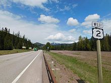
The western segment of US 2 extends west from the Upper Peninsula of Michigan across the northern tier of the lower 48 states.
US 2 is an east–west highway that runs through North Dakota's northern tier of larger cities: Williston, Minot, Devils Lake, and Grand Forks.
US 2 intersects US 85 at Williston, US 52 and US 83 at Minot, US 281 at Churchs Ferry (west of Devils Lake), and the I-29/US 81 concurrency at Grand Forks.
[4][5] After crossing the Bong Bridge and entering into the city of Superior, Wisconsin's western segment of the highway joins Belknap Street.
US 2 enters Michigan at the city of Ironwood and runs east to the town of Crystal Falls, where it turns south and re-enters Wisconsin northwest of Florence.
From there, it crosses the Richelieu River at the outlet of Lake Champlain[7] on the Rouses Point Bridge into Grand Isle County, Vermont.
Once into New Hampshire, the road continues southeastward, passing through Jefferson (home to several small amusement parks and roadside attractions, such as Santa's Village) before heading more easterly, skirting the northern edge of the White Mountain National Forest into Gorham, where it meets Route 16, the major north–south roadway through the eastern half of the forest and past Mount Washington.
From Gorham, the road travels east along the southern banks of the Androscoggin River to Shelburne and eventually crosses into Gilead, Maine.
It crossed Lake Champlain on the Burlington–Port Kent Ferry and headed west across Upstate New York, through Watertown and Rochester to Buffalo.
This portion took the route past Duluth, Minnesota; Minot, North Dakota; Havre, Montana; and Glacier National Park to Spokane, Washington.
East of St. Ignace, instead of crossing to the Lower Peninsula of Michigan like the Roosevelt Highway, the proposed US 2 traveled north to the international border at Sault Ste.
[13] By the time the U.S. Highway system was finalized in late 1926, one relatively minor change had been made to US 2; it was swapped with US 1 between Bangor and Houlton, Maine, placing US 2 along the entire portion of Route 15 east of St. Johnsbury.
Several other major parts of the auto trail received numbers, most notably US 30 from Portland, Oregon east to Pendleton, US 195 in eastern Washington, and US 23 in the Lower Peninsula of Michigan.
[14][15] In the mid-1930s, much of New York's portion of the road became US 104, and the part southeast of Littleton, New Hampshire, to Portland, Maine, became US 302,[citation needed] but by far the longest piece was that followed by US 2 between St. Ignace and Bonners Ferry.
In 1946, US 2 was extended west of its original western terminus in Bonners Ferry in Idaho to Everett in Washington via Spokane along what was then US 10A.
It ran from Evergreen Shores, north of St. Ignace, to present-day M-123 and replaced the former route on State Street and Mackinac Trail.
[16] Before being designated as US 2, most of the current alignment was called New England Interstate Route 15 from Danville, Vermont, eastward to Maine.