U.S. Route 20 in New York
It is, however, a major artery in many of the outlying areas it passes through in the hilly fringes of the Allegheny Plateau, often expanding to four lanes (it has no limited-access sections, although many intersecting roads are grade-separated) with extensive commercial strip development.
In the Buffalo area, US 20 begins to head more east, widening to four lanes and becoming a busy regional artery that intersects many other roads of major and minor importance.
For the five miles (8.0 km) leading into Depew, it runs due north along with NY 78 as part of Transit Road, a busy commercial strip east of the city.
A mile and a half (2.4 km) east of the state line, Shortman Road[citation needed] (unsigned NY 950D[6]) leaves to the left for exit 61, the westernmost interchange on the Thruway.
[citation needed] Another eight miles (13 km) of two-lane rural road, crossed at its midpoint by the onetime New York Central Railroad and now CSX Transportation mainline, brings US 20 into its first incorporated community, the village of Westfield.
[3] Past this junction, the Thruway and US 20 begin to converge in flatter country until they cross as US 20 veers northward one mile (1.6 km) south of Silver Creek.
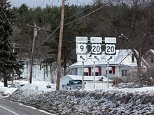
[citation needed] This hamlet was once home to a six-way intersection featuring US 20A,[7] but a late 2000s reconstruction project moved the west end of US 20A to a new junction to the northeast.
On home game days in the fall, traffic clogs the highway as it crosses over the US 219 expressway and curves northeast to reach the eastern terminus of NY 179 at Mile Strip Road.
[citation needed] Shops and stores line busy Transit Road on both sides as it divides the towns of West Seneca and Elma.
Increasing development and traffic heralds Transit Road's entry into the village of Depew, and, at NY 130, US 20 turns east, ending the overlap and taking the direction it will follow for most of the rest of its crossing of the state.
[citation needed] Taking the name Broadway, which NY 130 had retained from the city of Buffalo, US 20 goes through downtown Depew before it proceeds into the neighboring village of Lancaster.
It returns to a rural two-lane road beyond Lancaster, passing through a traffic light only at the small village of Alden before crossing into Genesee County.
[citation needed] Past the junction with NY 238, which forks off to the southeast toward Attica, the highway begins going straight up and down into the creek valleys here at the northern fringe of the Allegheny Plateau.
[citation needed] The 67-mile (108 km) concurrency that begins here is the longest in the state,[1] and it carries the two routes across the northern Finger Lakes region, a section of the plateau where glaciers carved deep valleys only to fill them with their meltwater.
From here, the road runs straight in a slightly more easterly direction south of Montezuma National Wildlife Refuge, where the Thruway is briefly visible to the north, before entering Cayuga County as it crosses over the Cayuga–Seneca Canal.
[citation needed] The landscape starts to grow hillier as it begins to cross the glacial moraines of the less populated reaches of southern Onondaga County.
[citation needed] From LaFayette, it drops into another deep valley, curving around an area known as Big Bend, prior to climbing back up five miles (8.0 km) towards the crest of the ridge at Pompey.
[citation needed] East of Cazenovia, US 20 resumes its southward drift as it climbs into the high ground again and expands to four lanes, passing the small village of Morrisville in the process.
This overlap lasts for three miles (4.8 km) to Birmingham Corners, where NY 51 turns north toward Ilion, as US 20 continues east and soon reenters Otsego County.
[citation needed] From here, the highway, now known as Western Turnpike, continues to trend to the south for another four miles (6.4 km) to the southern terminus of NY 406 at the hamlet of Gifford.
[citation needed] A half-mile (0.80 km) later, the busy four-lane route passes the south side of the State University of New York at Albany's highly modernistic campus.
[citation needed] After Washington Park on the north side, downtown Albany draws nearer, with Erastus Corning Tower, the tallest building in the state outside of New York City, rising ahead.
[citation needed] At the east end of the bridge, US 9 and US 20, now in the city and county of Rensselaer, follow the offramps past the stubs built for the canceled South Mall Expressway and assume a southeastern course along a busy four-lane strip containing a center turn lane.
The road subsequently goes up a hill with a panoramic view of the Albany skyline behind it and proceeds into the town of East Greenbush, where NY 151 heads off to the northeast.
[citation needed] In Schodack, development along the road begins to ease as the center turn lane gives way to a double yellow line.
In the center of this small town, US 20 meets NY 22, the longest north–south route in the state, and the two form a one-mile (1.6 km) overlap, US 20's last concurrency in New York.
The First Great Western Turnpike Corporation was chartered in 1799 to build a road from Albany, the capital of New York, to the Revolutionary War frontier town of Cherry Valley.
[16][17] West of modern-day Utica, Route 6 followed the old Genesee Road, a highway that passed through Auburn, Geneva, Avon, and Batavia on its way to Buffalo.
[19] The portion from Auburn to Skaneateles was brought up to state highway standards c. 1930[24][25] while the section connecting LaFayette (US 11) to Pompey (NY 91) was built by the following year.
[51] The 372-mile (599 km) US 20 is lined with historical places, including Sharon Springs, Cherry Valley, Bouckville, Cazenovia, Skaneateles, Auburn, Geneva, and East Aurora.