U.S. Route 29 in Virginia
It covers 248.0 miles (399.1 km) from the North Carolina border at the city of Danville to the Key Bridge in Washington DC.
[2][3] Through Northern Virginia, it is known as the Lee Highway, except in Falls Church, where it acts as the east–west divider for city streets and is called North or South Washington Street, and Arlington, where it was renamed Langston Boulevard in July 2021 in honor of John Mercer Langston.
These bypasses are around Danville, Chatham, Gretna, Hurt–Altavista, Lynchburg–Madison Heights–Amherst, Lovingston, Charlottesville, Madison, Culpeper, Remington, and Warrenton.
US 29 then continues north where it has business routes for Chatham, Gretna, and Hurt while bypassing them before entering Campbell County.
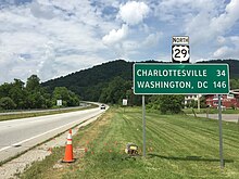
Past Charlottesville, it converts back to four lanes and continues through Greene and Madison counties and then turns northeast toward Culpeper.
US 29 continues into Fairfax County, where it passes along the boundary of the city of Falls Church, where the road has two different names.
[6] The portion of what is now US 29 from the North Carolina state line to Warrenton was named the Seminole Trail by an act of the Virginia General Assembly on February 16, 1928.
Many road maps of the 1930s and 1940s list the Seminole Trail on highways in Virginia, the Carolinas, Georgia, and ultimately Florida.
[7] In an October 4, 2006, meeting of the Albemarle County Board of Supervisors, the University of Virginia athletic department and basketball coach Dave Leitao suggested that Seminole Trail in Charlottesville should be renamed Cavalier Way.
The project was worth $230 million (equivalent to $307 million in 2023[9]) and included interchanges at many other heavily traveled roads in the area due to the rapid growth in development in Gainesville and Haymarket, along with it being a major area drivers departure off of I-66 to travel towards other major cities along the Lee Highway, such as Charlottesville.
The plan included a single-point urban interchange design and bridges over train tracks to ease traffic flow on the Lee Highway onto I-66.
The Lynchburg Interchange project took place at the intersection of US 29/US 460/US 501 and Odd Fellows Road, with construction starting in January 2016 and ending in August 2018.
Engineering and environmental work on the project began in late 1984, and the location was approved by the Commonwealth Transportation Board in 1990.
In 1996, the Charlottesville-Albemarle Metropolitan Planning Organization (MPO) inserted language into its Transportation Improvement Program that prevented additional funds from being allocated to construction of the Western Bypass.
[14] All activities on the US 29 Charlottesville Bypass project were suspended in March 2014 following notification from the FHWA that a new supplemental EIS would be required before the environmental process could be completed.