U.S. Route 44
NY 55, concurrent with US 209 southwest of this point, turns east onto US 44, forming an overlap as the two routes proceed eastward across Ulster County.
US 44 and NY 55 join US 9W for roughly a half-mile southward along the western bank of the Hudson River before separating at a trumpet interchange south of Highland.
At the eastern end of the parallel roadways in Arlington, just outside Poughkeepsie, US 44 and NY 55 split upon meeting Main Street at an interchange.
NY 55 continues southeast through the junction as Manchester Road; US 44, however, joins Main Street to the northeast along what becomes the Dutchess Turnpike.
West of the interchange, state maintenance continues along Main Street for an additional 0.19 miles (0.31 km) to County Route 38 (CR 38, named Fairmont Avenue).
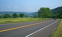
From Arlington, US 44 bends first to the north, then after 1.5 miles northeast, through intermittently developed areas, woodlots, and farms to the next settlement along its route, Pleasant Valley.
A mile past it, at the state police Troop K barracks, NY 82 joins from the north and the two roads overlap.
This concurrency ends after another mile, when US 44 diverges along the route of the former NY 44A, going around the village of Millbrook past the Mary Flagler Cary Arboretum, home to the Institute of Ecosystem Studies.
US 44 gradually descends into the upper Harlem Valley, with a sharp hairpin turn providing a panoramic view to the south.
A seven-mile (11 km) journey over increasingly rolling and open terrain takes the two highways into the town of North East and towards Millerton.
At the traffic light just north of that bend, US 44 leaves NY 22 and turns right through Millerton's historic downtown.
It is also known by more local names, including Albany Turnpike in Canton, West/East Main Street and Avon Mountain Road in Avon, Albany Avenue through West Hartford into Hartford, Boston Turnpike from Bolton Notch to Ashford, and Providence Pike near the Rhode Island border.
In Canton, US 44 becomes a four-lane primary suburban arterial road as it is joined by US 202 for a 4.3-mile (6.9 km) concurrency to the center of Avon.
It then enters Mansfield, where it meets Route 195 at the "Four Corners", which provides access to the village of Storrs and the main campus of the University of Connecticut.
4.66 miles (7.50 km) to the east, US 44 crosses the Rhode Island state line into the town of Glocester.
It continues eastward from Taunton through the towns of Raynham, Lakeville, Middleborough, Carver, Plympton and Kingston before reaching its eastern terminus at Plymouth.
After that, it becomes a newly built, 7.5-mile-long (12.1 km) freeway section to Route 3 which bypasses the congested business district in Plymouth.
The route runs along the south side of Taunton Green, flanked by shops, businesses, and government buildings.
The portion of US 44 between Poughkeepsie and Amenia was the main line of an early toll road known as the Dutchess Turnpike.
[8][9] The Farmer's Turnpike continued east past Ardonia to the village of Milton where a ferry across the Hudson River once existed.
[10] In 1924, when state highways were first marked by route numbers in New York, the main line of the Dutchess Turnpike was designated as NY 21.
West of the Hudson River, NY 55 was also designated in 1930 between Barryville and Pawling, running along the portion of modern US 44 between Kerhonkson and Poughkeepsie.
[14][15] West of the Hudson River, it was overlaid on the pre-existing NY 55, with US 44 officially beginning at US 209, which was also extended into New York c. 1935.
[6] Most of the alignment of modern US 44 in Connecticut was at one time part of an early network of turnpikes in the state during the 19th century.
The southeastward continuation of the Greenwoods road to the West Hartford-Hartford line was known as the Talcott Mountain Turnpike.
Past Pomfret Center, the Boston Turnpike diverged from modern US 44 heading northeast across the town of Thompson.
Route 101 extended across Rhode Island and Massachusetts along modern US 44, with an extension into Connecticut along an alignment different from US 44.
Connecticut and Rhode Island reassigned the Route 101 designation to a much shorter but parallel alignment between the two states.
On December 14, 2005, a freeway realignment opened to the north of the original surface alignment US 44 in the towns of Carver and Plymouth.