U.S. Route 50
Until 1972, when it was replaced by Interstate Highways west of the Sacramento area, it extended (by way of Stockton, the Altamont Pass, and the Bay Bridge) to San Francisco, near the Pacific Ocean.
The route runs through mostly rural desert and mountains in the western United States, with the section through Nevada known as "The Loneliest Road in America".
Signs at each end give the length as 3,073 miles (4,946 km), but the current distance is slightly less due to realignments since that figure was calculated.
The road begins a much longer overlap with Interstate 70 in Salina crossing the Wasatch Plateau and San Rafael Swell into Colorado.
Once there, the road climbs to its highest elevation of 11,312 feet (3,448 m)[5] over the Rocky Mountains and in Monarch Pass where it crosses the Continental Divide.
[6] Upon entering Kansas, US 50, concurrent with US 400, runs along the Arkansas River to Dodge City where US 50 splits from US 400 and takes a more northerly course.
US 50 runs as a four-lane divided highway across the Western Plain to Sedalia where it continues as a two-lane road until reaching California, MO about 20 miles west of Jefferson City.
The road continues as a four-lane divided highway into Jefferson City where it joins US 63 just south of the Missouri River Bridge.
It then continues as a two-lane road as it traverses the northern sections of the Ozark Highlands east to Union where it begins an overlap with Interstate 44 which goes through Pacific.
The routes separate in Sunset Hills where US 50 migrates southeast bypassing St Louis by joining Interstate 255 to cross Mississippi River into Illinois.
The land flattens out after the route crosses the Blue Ridge Mountain east of Winchester, and it follows the old Little River Turnpike from Aldie to Fairfax City and the newer Arlington Boulevard to Rosslyn, where it crosses the Washington, D.C. line on the west shore of the Potomac River and joins Interstate 66 on the Theodore Roosevelt Bridge.
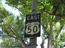
[6] Within the District, US 50 immediately exits the freeway onto Constitution Avenue along the north side of the National Mall and south of the White House.
Upon crossing into Maryland, it passes the south end of the Baltimore-Washington Parkway and becomes the John Hanson Highway, a freeway to Annapolis.
The portion of this highway east of the Capital Beltway (I-95/I-495) is also designated, but not signed as, Interstate 595, and U.S. Route 301 joins from the south at Bowie.
[13] Another straightening was made in 1976, when US 50 in central Utah was moved south onto the new extension of Interstate 70 at the request of the National Highway 50 Federation,[14][15] a group dedicated to promoting US 50.