U.S. Route 9 in Delaware
U.S. Route 9 (US 9) is a United States Numbered Highway in the Northeastern U.S., running from Laurel, Delaware, north to Champlain, New York.
From the western terminus, the route heads to the northeast on two-lane undivided County Seat Highway.
Past this intersection, US 9 becomes undivided again and continues through rural land, crossing Tyndall Branch and passing to the southeast of the University of Delaware's Carvel Research and Education Center and Sussex Technical High School.
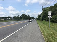
Farther northeast, the road reaches the town of Georgetown and intersects US 113/DE 404 Truck in a commercial area.
[4][5] At this point, US 9 continues northeast concurrent with DE 404 on East Market Street through the downtown area.
The road crosses the Delmarva Central Railroad's Indian River Subdivision line at-grade and runs through residential areas with a few businesses, passing south of the Southern Delaware Tourism Visitors Center.
Following this intersection, US 9/DE 404 passes through more rural land, reaching a junction with DE 5 near businesses in the community of Harbeson.
A short distance later, the route turns north-northeast onto two-lane undivided Kings Highway, passing through farmland with some residential subdivisions and heading to the east of Cape Henlopen High School.
The route runs between developed areas to the northwest and rural areas and the parallel Junction and Breakwater Trail to the southeast before crossing over the trail, Gills Neck Road, and the Lewes and Rehoboth Canal on a high-level bridge.
and turns east onto Cape Henlopen Drive, passing between residential development along the Delaware Bay to the north and the abandoned railroad tracks to the south.
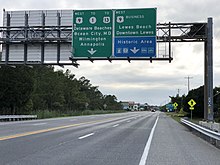
[4][5] The section of US 9 between US 113 and DE 1 serves as part of a primary hurricane evacuation route from the Delaware Beaches to points inland while the section of US 9 between US 13 and US 113 serves as part of a secondary hurricane evacuation route from the coastal areas.
[10] What is currently US 9 in Delaware existed as a state highway between Whaleys Corners and Georgetown by 1920, with the remainder as an unimproved county road.
[13] A year later, what is now US 9 along the DE 1 concurrency between Wescoats Road and Carpenters Corner was built as a state highway.
[11] By 1954, US 13 was moved to a new alignment to the east of Laurel, and the western terminus of DE 28 was truncated from Central Avenue to the new location of US 13.
[17][18] On December 21, 1965, the Delaware Senate approved a resolution for the approach road to the ferry to be named the Theodore C. Freeman Highway after Theodore C. Freeman, an astronaut who attended Lewes Elementary School from 1936 to 1944 that was killed in a plane accident while training on October 31, 1964.
was designated onto the former alignment of DE 18 between Five Points and Lewes as well as a portion of Cape Henlopen Drive connecting to US 9.