Universal Transverse Mercator coordinate system
The Universal Transverse Mercator (UTM) is a map projection system for assigning coordinates to locations on the surface of the Earth.
Like the traditional method of latitude and longitude, it is a horizontal position representation, which means it ignores altitude and treats the earth surface as a perfect ellipsoid.
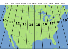
However, it differs from global latitude/longitude in that it divides earth into 60 zones and projects each to the plane as a basis for its coordinates.
Most zones in UTM span 6 degrees of longitude, and each has a designated central meridian.
[3] However, a series of aerial photos found in the Bundesarchiv-Militärarchiv (the military section of the German Federal Archives) apparently dating from 1943–1944 bear the inscription UTMREF followed by grid letters and digits, and projected according to the transverse Mercator,[4] a finding that would indicate that something called the UTM Reference system was developed in the 1942–43 time frame by the Wehrmacht.
It was probably carried out by the Abteilung für Luftbildwesen (Department for Aerial Photography).
From 1947 onward the US Army employed a very similar system, but with the now-standard 0.9996 scale factor at the central meridian as opposed to the German 1.0.
For the remaining areas of Earth, including Hawaii, the International Ellipsoid[6] was used.
The World Geodetic System WGS84 ellipsoid is now generally used to model the Earth in the UTM coordinate system, which means current UTM northing at a given point can differ up to 200 meters from the old.
Prior to the development of the Universal Transverse Mercator coordinate system, several European nations demonstrated the utility of grid-based conformal maps by mapping their territory during the interwar period.
Calculating the distance between two points on these maps could be performed more easily in the field (using the Pythagorean theorem) than was possible using the trigonometric formulas required under the graticule-based system of latitude and longitude.
This projection is conformal, which means it preserves angles and therefore shapes across small regions.
The UTM system divides the Earth into 60 zones, each 6° of longitude in width.
Each of the 60 zones uses a transverse Mercator projection that can map a region of large north-south extent with low distortion.
By using narrow zones of 6° of longitude (up to 668 km) in width, and reducing the scale factor along the central meridian to 0.9996 (a reduction of 1:2500), the amount of distortion is held below 1 part in 1,000 inside each zone.
In each zone the scale factor of the central meridian reduces the diameter of the transverse cylinder to produce a secant projection with two standard lines, or lines of true scale, about 180 km on each side of, and about parallel to, the central meridian (Arc cos 0.9996 = 1.62° at the Equator).
The scale is less than 1 inside the standard lines and greater than 1 outside them, but the overall distortion is minimized.
Around the boundaries of large scale maps (1:100,000 or larger) coordinates for both adjoining UTM zones are usually printed within a minimum distance of 40 km on either side of a zone boundary.
To avoid dealing with negative numbers, a false Easting of −500000 meters is added to the central meridian.
Thus a point that has an easting of 400000 meters is about 100 km west of the central meridian.
For most such points, the true distance would be slightly more than 100 km as measured on the surface of the Earth because of the distortion of the projection.
These formulae are truncated version of Transverse Mercator: flattening series, which were originally derived by Johann Heinrich Louis Krüger in 1912.
[11][12] The WGS 84 spatial reference system describes Earth as an oblate spheroid along north-south axis with an equatorial radius of