Victory Mountains
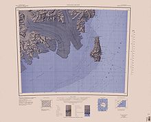
The Victory Mountains (72°40′S 168°00′E / 72.667°S 168.000°E / -72.667; 168.000 (Victory Mountains)) are a major group of mountains in Victoria Land, Antarctica, about 100 nautical miles (190 km; 120 mi) long and 50 nautical miles (93 km; 58 mi) wide, which is bounded primarily by Mariner and Tucker glaciers and the Ross Sea.
[1] A Ross Sea aspect of the mountains was first obtained by early British expeditions of James Clark Ross, Carsten Borchgrevink, Robert Falcon Scott and Ernest Shackleton.
The mapping of the interior mountains was largely done from air photos taken by the United States Navy and surveys undertaken by New Zealand and American parties in the 1950s and 1960s.
[2][3][4][5] The mountains to the east of the Malta Plateau and west of the Daniell Peninsula are not part of a formally named range.
[2][3][4][5] Download coordinates as: Mountains in the center of mountain groups in the east include: This article incorporates public domain material from websites or documents of the United States Geological Survey.