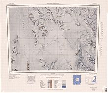
Barker Range
Named by the Southern Party of the New Zealand Federated Mountain Clubs Antarctic Expedition (NZFMCAE), 1962-63, after the JATO bottles used by American aircraft to assist in taking off with heavy loads at high elevations.
A peak on the polar plateau, situated 5 nautical miles (9.3 km; 5.8 mi) west of Joice Icefall of the Millen Range.
The nunatak was visited in 1981-82 by Bradley Field, geologist, New Zealand Geological Survey (NZGS), who suggested the name from the impressive icefalls that drop off at either side of the feature.
A peak, 2,715 metres (8,907 ft) high, located 3 nautical miles (5.6 km; 3.5 mi) northwest of Mount Roy.
Laird and derives from the forced lay-over of his field party in an emergency tent due to bad weather on the pass during 1981-82.
A peak 2 nautical miles (3.7 km; 2.3 mi) northeast of Mount McCarthy, rising to about 2,850 metres (9,350 ft) high.
A peak 2,470 metres (8,100 ft) high on the north side of Trafalgar Glacier, 4 nautical miles (7.4 km; 4.6 mi) northwest of Mount Burton.
McDonald, who lives in New Zealand, was a guest of the United States Navy during the 1962-63 Antarctic season when he visited the continent again with two others of Scott's veterans.
A graywacke peak 2,740 metres (8,990 ft) high standing at the west side of the mouth of Osuga Glacier.
Burton, who lived in New Zealand, was a guest of the United States Navy during the 1962-63 Antarctic season when he visited the continent again with two others of Scott's veterans.