Mount Freeman
It was named by the United States Advisory Committee on Antarctic Names (US-ACAN) for Lieutenant Elliott R. Freeman, United States Navy Reserve, a helicopter aircraft commander during Operation Deep Freeze, 1968.
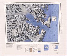
Mapped in detail by USGS from surveys and United States Navy air photos, 1960-62.
A major peak, 2,910 metres (9,550 ft) high, situated 2 nautical miles (3.7 km; 2.3 mi) southeast of Mount Freeman.
One of the highest peaks in the east end of the Victory Mountains, rising to 2,610 metres (8,560 ft) high on the west side of Whitehall Glacier and 5 nautical miles (9.3 km; 5.8 mi) southwest of Mount Northampton.
A rock spur on the south side of Tucker Glacier, 10 nautical miles (19 km; 12 mi) west of Crater Cirque, on which a survey station was placed at a height of 1,185 metres (3,888 ft) high by the NZGSAE, 1957-58.
As part of his official duties in support of the United States science program, he visited several sites in Antarctica in 1975.
A mountain 2,465 metres (8,087 ft) high that rises above the central part of the ridge just east of Bowers Glacier.
Discovered in January 1841 by Sir James Clark Ross, who named it for the Spencer Compton, 2nd Marquess of Northampton, then President of the Royal Society.
A peak 2,250 metres (7,380 ft) high 2 nautical miles (3.7 km; 2.3 mi) northeast of Mount Northampton.
A pointed rock spur 4 nautical miles (7.4 km; 4.6 mi) east of Mount Northampton.
[15] This article incorporates public domain material from websites or documents of the United States Geological Survey.