Viewshed analysis
It is a common part of the terrain analysis toolset found in most geographic information system (GIS) software.
For example, a viewshed analysis is commonly used to locate communication towers or determining the view from a road.
The viewing angle, or azimuth, of the radio tower can be incorporated into the calculation by adding two values.
This variable would need to be added in cases where the radio tower emits a very narrow vertical beam.
Viewshed analyses are also used to locate fire observation stations in mountain areas (Lee and Stucky, 1998).
An example of using a viewshed analysis on a line segment is from the Wyoming State Office, Bureau of Land Management, in which the office used a viewshed analysis to determine the visibility from National Historic Trails across Wyoming.
This is an indication of what the pioneers could see as they traveled along the trails of the western frontier (Rock Springs Field Office).
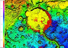
In another example the United States Geological Survey (USGS) used a viewshed analysis to assist NASA's Mars Exploration Rover (MER) project.
When NASA needed to find appropriate landing spots for the Mars rovers, they turned to the USGS to map the best possible sites.