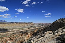
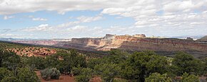
Waterpocket Fold
This monoclinal fold extends for nearly 100 miles (160 km) in the semi-arid plateau of the central part of the state.
The structure defines the Capitol Reef National Park in southern Utah.
The park's Scenic Drive leads to a famous landmark known as the Golden Throne.
The northern portion of the Waterpocket Fold lies north and east of the town of Fruita, three miles (4.8 km) west and just southeast of the Middle Desert.
The southern end of the structure extends to the Colorado River just southwest of Halls Crossing.