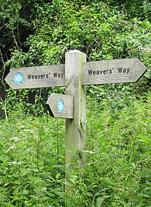
Weavers' Way
The Weavers' Way is a 61-mile (98 km) long-distance footpath in Norfolk, England.
[1] Much of the Weavers’ Way footpath follows the old trackbed of the Aylsham to Great Yarmouth railway line, which was operated by the Midland and Great Northern Joint Railway and was closed in 1959.
It passes through Hanworth, Aylsham, North Walsham, Worstead, Stalham, Potter Heigham, Thurne and Halvergate; it then crosses the marshes around Berney Arms and skirts the northern edge of Breydon Water where it shares the same route as the Wherryman's Way.
At Cromer, the Weavers' Way links with the North Norfolk Coastal Path; at Great Yarmouth, it joins the Angles Way.
Download coordinates as: 52°46′38″N 1°30′09″E / 52.7773°N 1.5026°E / 52.7773; 1.5026 (Weavers' Way) This Norfolk location article is a stub.