Westwood, Michigan
It is a census-designated place (CDP) for statistical purposes and does not have any legal status as an incorporated municipality.
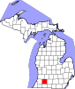
M-43 is a state highway that runs through the southern part of the community, leading east into downtown Kalamazoo and west 35 miles (56 km) to South Haven on Lake Michigan.
According to the United States Census Bureau, the Westwood CDP has a total area of 2.9 square miles (7.4 km2), all land.
There were 4,505 housing units at an average density of 1,609.0 per square mile (621.2/km2).
35.7% of all households were made up of individuals, and 13.7% had someone living alone who was 65 years of age or older.