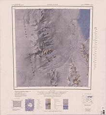
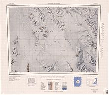
Outback Nunataks
The group lies south of Emlen Peaks of the Usarp Mountains and west of Monument Nunataks and upper Rennick Glacier, adjacent to the featureless interior plateau.
A very prominent mountain that is surmounted by three peaks, the highest 2,505 metres (8,219 ft) high, standing 5 nautical miles (9.3 km; 5.8 mi) southeast of Mount Southard.
Two prominent rock nunataks along an ice cliff, situated 7 nautical miles (13 km; 8.1 mi) southwest of Welcome Mountain.
Named by US-ACAN to express appreciation for the dedicated support provided to Antarctic programs by home-based personnel.
A north-facing rock and ice cliff, about 4 nautical miles (7.4 km; 4.6 mi) long, situated just northwest of Mount Walton.
A sharp, bare mountain 2,460 metres (8,070 ft) high rising midway between Oona Cliff and Mount Chadwick.
A small, bare rock mountain 2,440 metres (8,010 ft) high situated 2.5 nautical miles (4.6 km; 2.9 mi) east-southeast of Mount Walton.
Named by US-ACAN after Wilfred I. Doe, United States Navy, hospital corpsman with the McMurdo Station winter party, 1967.
A ridgelike mountain 2,510 metres (8,230 ft) high standing 3 nautical miles (5.6 km; 3.5 mi) northwest of Mount Bower.
Named by US-ACAN for Albert T. Joern, a researcher in physiopsychology with the winter party at South Pole Station, 1968.
A prominent mountain 2,610 metres (8,560 ft) high standing 6 nautical miles (11 km; 6.9 mi) east-northeast of Roberts Butte.
A mountain, 2,270 metres (7,450 ft) high, standing 10 nautical miles (19 km; 12 mi) west-southwest of Mount Weihaupt.
Named by US-ACAN for Robert W. Koons, United States ArmyRP logistics coordinator with the McMurdo Station winter party, 1968.
A group of rocks along an ice bluff situated 5 nautical miles (9.3 km; 5.8 mi) southeast of Miller Butte.
A small, isolated bluff standing 9 nautical miles (17 km; 10 mi) east-southeast of Miller Butte.
A small but conspicuous mountain 2,120 metres (6,960 ft) high standing 6 nautical miles (11 km; 6.9 mi) northwest of Mount Weihaupt.
Named by US-ACAN for Neal Potter, economist, McMurdo Station, 1965-66, who made a study of the economic potentials of Antarctica.
A large, mainly ice-free mountain 2,805 metres (9,203 ft) high situated 20 nautical miles (37 km; 23 mi) south-southeast of Roberts Butte of the Outback Nunataks, and 11 nautical miles (20 km; 13 mi) west-northwest of the Sequence Hills, near the edge of the featureless, interior ice plateau.
A lone nunatak located 2 nautical miles (3.7 km; 2.3 mi) west of the south end of Frontier Mountain.
Named by US-ACAN for Ronald F. Wilds, aviation machinist's mate with USN Squadron VX-6 at McMurdo Station, 1966.