World file
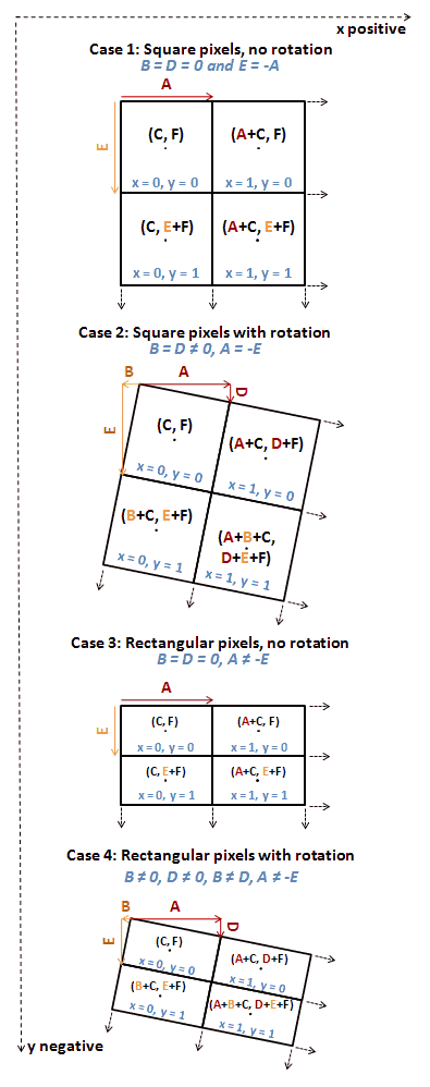
When D or B are non-zero the pixel width is given by: and the pixel height by World files describing a map on the Universal Transverse Mercator coordinate system (UTM) use these conventions: The above description applies also to a rectangular, non-rotated image which might be, for example, overlaid on an orthogonally projected map.
If the world file describes an image that is rotated from the axis of the target projection, however, then A, D, B and E must be derived from the required affine transformation (see below).
These values are used in a six-parameter affine transformation: which can be written as this set of equations: where: The y-scale (E) is negative because the origins of an image and the UTM coordinate system are different.
In this case, approximate latitude and longitude (41.2, −072.7) were looked up in a gazetteer and the UTM (grid) zone was found to be 18 using a Web-based converter.
There are three filename extension naming conventions used for world files, with variable support across software.