Watling Street
The line of the road was later the southwestern border of the Danelaw with Wessex and Mercia, and Watling Street was numbered as one of the major highways of medieval England.
First used by the ancient Britons, mainly between the areas of modern Canterbury and St Albans using a natural ford near Westminster, the road was later paved by the Romans.
It connected the ports of Dubris (Dover), Rutupiae (Richborough Castle), Lemanis (Lympne), and Regulbium (Reculver) in Kent to the Roman bridge over the Thames at Londinium (London).
The continuation on to Blatobulgium (Birrens, Dumfriesshire) beyond Hadrian's Wall in modern Scotland may have been part of the same route, leading some scholars to call this Watling Street as well, although others restrict it to the southern leg.
The modern name instead derives from the Old English Wæcelinga Stræt, from a time when "street" (Latin: via strata) referred to any paved road and had no particular association with urban thoroughfares.
The main path led from Richborough on the English Channel to a natural ford in the Thames at Thorney Island,[6] Westminster, to a site near Wroxeter, where it split.
[7] There is a longstanding tradition[citation needed] that a natural ford once crossed the Thames between Thorney Island (present-day Westminster) and the Lambeth/Wandsworth boundary.
Several factors may have slowed the river here, leading to the depositing of enough sediments to create a usable ford:[9] The Romans began constructing paved roads shortly after their invasion in AD 43.
The London portion of Watling Street was rediscovered during Christopher Wren's rebuilding of St Mary-le-Bow in 1671–73, following the Great Fire.
[10] The road ran straight from the bridgehead on the Thames[11] to what would become Newgate on the London Wall before passing over Ludgate Hill and the Fleet and dividing into Watling Street and the Devil's Highway west to Calleva (Silchester).
[12] The 2nd-century Antonine Itinerary gives the course of Watling Street from "Urioconium" (Wroxeter) to "Portus Ritupis" (Richborough) as a part of its Second Route (Iter II), which runs for 501 MP from Hadrian's Wall to Richborough:[13][14] Some site in the middle section of this route is supposed by most historians to have been the location of G. Suetonius Paulinus's decisive victory over Boudica's Iceni in AD 61.
The route between Durovernum and the fortress and port at Regulbium (Reculver) on Kent's northern shore is not given in these itineraries but was also paved and is sometimes taken as a fourth terminus for Watling Street.
The Sixth Route (Iter VI) also recorded an alternate path stopping at Tripontium (Newton and Biggin) between Venonis (High Cross) and Bannaventa (Norton); it is listed as taking 24 Roman miles rather than 17.
[citation needed] The first turnpike trust in England was established over Watling Street northwest of London by an Act of Parliament on 4 March 1707 in order to provide a return on the investment required to once more pave the road.
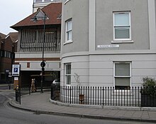
The name Watling Street is still used along the ancient road in many places, for instance in Bexleyheath in southeast London and in Canterbury, Gillingham, Strood, Gravesend, and Dartford in Kent.
North of London, the name Watling Street still occurs in Hertfordshire (including St Albans), Bedfordshire (Dunstable), Buckinghamshire (Milton Keynes), Northamptonshire (Towcester), Leicestershire (Hinckley), Warwickshire (Nuneaton and Atherstone) and in Staffordshire (Cannock, Wall, Tamworth and Lichfield).