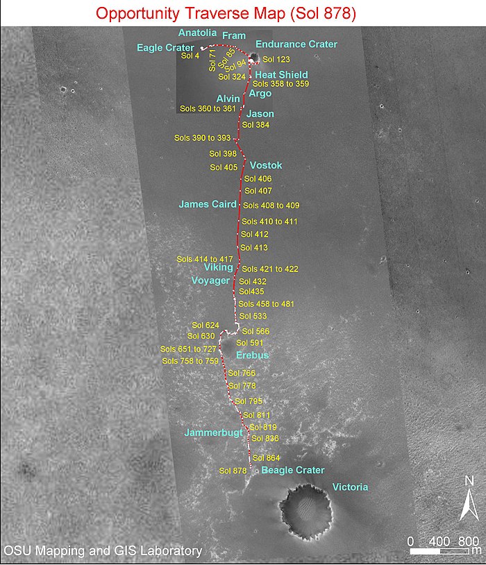
Timeline of Opportunity
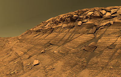
[7] A picture received on February 10 (taken on Sol 16) showed that the thin layers in the bedrock converge, and diverge at low angles, suggesting that some "moving current" such as volcanic flow, wind, or water formed these rocks.
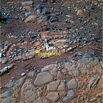
A specific target in the outcrop (dubbed "El Capitan"), whose upper and lower portions appeared to differ in layering and weathering characteristics, was selected for further investigation.
By inspecting the sides and floor of a hole it dug, Opportunity found some things it had not imaged beforehand, including shiny round pebbles and soil so fine-grained that the rover's microscope could not make out individual particles.
On sol 127 June 4, 2004 mission members announced their intention to drive Opportunity into Endurance, even if it should turn out to be impossible to get back out, targeting the various rock layers that were identified in the pictures from the crater rim.
"This is a crucial and careful decision for the Mars Exploration Rovers' extended mission", said Dr. Edward Weiler, NASA's associate administrator for space science.
Steve Squyres, principal investigator from Cornell University said: "Answering the question of what came before the evaporites is the most significant scientific issue we can address with Opportunity at this time.
After various simulations intended to mimic the properties and behavior of Martian sand were completed, the rover executed its first wheel movements on sol 461 (May 13, 2005), intentionally advancing only a few centimeters, after which mission members evaluated the results.
Fortunately for Opportunity, the rover was equipped with a built-in safety mechanism called a "T-stat box" (thermostatic switch) that provided protection against overheating.
When the Sun came up the next morning and sunlight began hitting the solar arrays, the batteries automatically reconnected, the robotic arm became operational, the shoulder joint warmed up, and the thermostatic switch opened, disabling the heater.
Scientists believed that rock outcrops along the walls of Victoria would yield more information about the geologic history of Mars, if the rover survived long enough to investigate them.
The dust storms continued through July and at the end of the month, NASA announced that the rovers, even under their very-low-power mode were barely getting enough energy to survive.
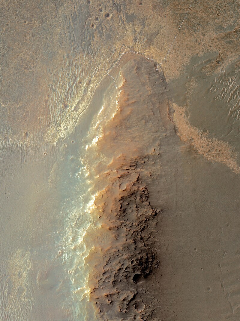
[38] Opportunity made a short drive into Duck Bay on sol 1290 September 11, 2007 and then reversed out again to test traction on the initial slope into Victoria Crater.
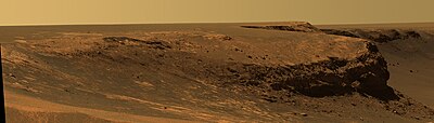
[39] On sol 1291 September 13, 2007 it returned to begin a more thorough exploration of the inner slope, examining a series of layers of pale-coloured rock in the upper parts of Duck Bay and the face of the promontory Cape Verde in detail.
At 08:30 local Mars time on Sol 1529 (May 14, 2008), they allowed Opportunity to direct as much current as possible to the warm, joint-1 azimuth motor in order to get the robotic arm into a usable position, in front of the rover.
[49] The drive actuator for the right front wheel, which had been rested while Opportunity studied a rock outcrop called "Penrhyn", had motor currents very close to normal levels.
[61] On sol 2231 (May 5, 2010), due to potentially hazardous dune fields along the direct path between Victoria and Endeavour, a new route was charted that extended the distance to travel between the two craters to 19 kilometers (12 mi).
[70] By sol 2699 (August 29, 2011), Opportunity had continued to function effectively 30 times longer than its planned 90-sol mission, aided by solar cell cleaning events, and performed extensive geological analysis of Martian rocks and planetary surface features with its instruments.
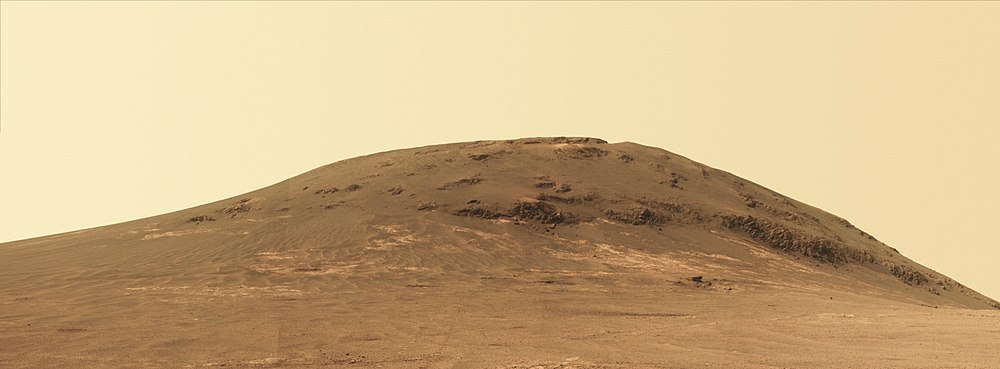
[72] Endeavour is 23 km (14 mi) wide and offers scientists new terrain to explore, including older rocks than encountered heretofore, and clay minerals that may have formed in the presence of water.
[73] The rover survived so long this goal was accomplished, and by 2016 it was decided to not only enter Endevaour crater but also explore, for the first time in history what is thought to be a water carved gully on Mars (update:2016).
Using three of the rover's instruments - the Microscopic Imager, the Alpha Particle X-Ray Spectrometer and the Panoramic Camera's filters - researchers determined the deposit to be hydrated calcium sulfate, or gypsum, a mineral that does not occur except in the presence of water.
[81] By March (around Sol 2890), 'Amboy' rock was studied with the MIMOS II Mössbauer spectrometer and the Microscopic Imager, and the amount of Argon gas in the Martian air was measured.
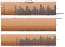
[111] By traveling to locations with favorable tilt, dubbed "lily pads", Opportunity managed to receive over about 300 watt-hours per day even as the heart of the Mars winter approached.
[119] Some communication and difficulties the previous month delayed investigating these rocks, but on the positive side, the wait, along with a cleaning event over January 1, allowed for more electrical power to be available.
[139] Though minor memory problems persisted in the immediate aftermath of reformatting, they did not hinder the rover's continued operation; Opportunity resumed driving towards "Ulysses" crater and "Marathon Valley," exceeding total odometry of 41 kilometers by November 11, 2014.
[143] MER-B was trying to reach a target on Knudsen Ridge, on the south side of Marathon Valley, which meant attempting a steep grade which can cause wheel slippage.
[150] During the beginning of October 2015, Opportunity began its drive to north-tilted slopes in Marathon Valley of the west rim of Endeavour crater in preparation for the Martian winter.
[189] (see also Martian spherules) Opportunity studied the rock target Jornada del Muerto in Perseverance Valley, using its surviving suite of instruments including the Microscopic Imager (MI), APXS, and the color cameras.
[189] At this time rocks from the Matijevic Formation have not been found, and the valley is proving to have some complicated natures[189] One area being studied is how the dust flows through channel and makes deposits.
[211] By early October, the storm subsided and the atmosphere cleared up, but the rover kept silent,[207] suggesting either a catastrophic failure or a layer of dust covered its solar panels.
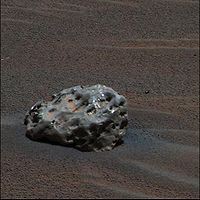
[214] Examples of watt-hours per sol collected by the rover:[218] Some of the craters MER-B has investigated Some excitement from finding meteorites, new types of rock or signatures detected from orbit, and speculations on ancient alien fossils which as of yet lean towards geological processes.


(July 2018)


( Mars Climate Sounder ; Mars Reconnaissance Orbiter )
(1:38; animation; October 30, 2018; file description

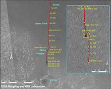
 Clickable image:
Clicking on the labels will open a new article.
Clickable image:
Clicking on the labels will open a new article.