Battle of Schliengen
A confusion of politics and diplomacy in Vienna wasted any strategic advantage that Charles might have obtained and locked the Habsburg force into two sieges on the Rhine, when the troops were badly needed in northern Italy.
In this War of the First Coalition (1792–98), France ranged itself against most of the European states sharing land or water borders with her, plus Portugal and the Ottoman Empire.
In total, though, the commander-in-chief Archduke Charles' troops stretched from Switzerland to the North Sea and Dagobert Sigmund von Wurmser's, from the Swiss-Italian border to the Adriatic.
[Note 1] Compared to French coverage, Charles had half the number of troops covering a 211-mile (340 km) front that stretched from Renchen near Basel to Bingen.
Furthermore, he had concentrated the bulk of his force, commanded by Count Baillet Latour, between Karlsruhe and Darmstadt, where the confluence of the Rhine and the Main made an attack most likely, as it offered a gateway into eastern German states and ultimately to Vienna, with good bridges crossing a relatively well-defined river bank.
The Austrian army consisted of professionals, many moved from the border regions in the Balkans, and conscripts drafted from the Imperial Circles.
Throughout the spring and early summer, the unpaid French army was in almost constant mutiny: in May 1796, in the border town of Zweibrücken, the 74th Demi-brigade revolted.
[5][6] In Spring, 1796, when resumption of war appeared imminent, the 88 members of the Swabian Circle, which included most of the states (ecclesiastical, secular, and dynastic) in Upper Swabia, had raised a small force of about 7,000 men.
[8] On 24 June, though, at Kehl, Moreau's advance guard, 10,000, preceded the main force of 27,000 infantry and 3,000 cavalry directed at the Swabian pickets on the bridge.
Most of the Imperial Army of the Rhine was stationed further north, by Mannheim, where the river was easier to cross, but too far away to support the smaller force at Kehl.
Neither the Condé's troops in Freiburg nor Karl Aloys zu Fürstenberg's force in Rastatt could reach Kehl in time to support them.
[12] Given the size of the attacking force, Charles had to withdraw far enough into Bavaria to align his northern flank in a perpendicular line with Wartensleben's autonomous corps to protect the Danube valley and deny the French primary access to Vienna.
[14] As Charles withdrew further east, the neutral zone established in Swabia expanded, eventually to encompass most of southern German states and the Ernestine duchies.
The Coalition's concentration of troops forced a wider wedge between the two armies of Jourdan and Moreau, similar to what the French had tried to do to Charles and Wartensleben.
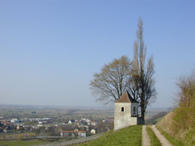
As a nineteenth-century traveler described it, the mountains in the vicinity [of Müllheim] are bold; the dark ravines contrasting with its sunny fronts offer some exquisite scenes.
The Rhine ... lay revealed before us for many a league, twisting and twining like a serpent of silver ... dotted with innumerable islands, and flowing through a most extensive plain, perfectly flat.
[...][19] The traveler described additional walks, in which the forest of dark pine bordered directly on the road, "checquered [sic] by glades in which browsed sheep and goats.
[16] On 18 September, part of an Austrian division under Feldmarschall-Leutnant Petrasch swept from Karlsruhe, south to Kehl and stormed the Rhine bridgehead there; he succeeded in holding it, with high losses (about 2,000 of his 5,000 men were killed, wounded or missing).
Michael Fröhlich and Condé (part of Friedrich Joseph, Count of Nauendorf's column) were to pin down Ferino and the French right wing in the Stieg valley.
Charles' combined forces of 24,000 closely followed Moreau's rear guard from Freiburg, southwest, to a line of hills stretching between Kandern and the river.
His entire force guarded a front protected by a small stream, the 14-mile (23 km) long Kander that meandered out of the mountains west of Kandern and plunged 755 feet (230 m) into the Rhine when it passed Steinstadt.
[26] The third column, commanded by the experienced Maximilian Anton Karl, Count Baillet de Latour, included 11 battalions and 2 regiments of cavalry.
The fourth, commanded by the dependable Friedrich Joseph, Count of Nauendorf, included the entire vanguard of Charles' corps and approached on the far Austrian left.
[28] Taking advantage of the royalist acquisition, the second column took the hill opposite Schliengen, which was heavily defended by General of Division Gouvion Saint-Cyr.
Saint-Cyr tried several times to retake the position, but Fürstenberg's column clung to its prize throughout the day,[29] despite a heavy cannonade from the French divisions opposite it.
His men had marched all of the preceding night; his column moved with the corps of General Latour to Feldburg, but by the castle of Bürgeln 3.9 miles (6 km) to the east at 47°44′0″N 7°49′0″E / 47.73333°N 7.81667°E / 47.73333; 7.81667, it turned to the left (west) to penetrate to the source of the Kandern stream.
With a strong rear guard provided by Abbatucci and Lariboisière, he abandoned his position the same night and retreated part of the 9.7 miles (16 km) to Hüningen.
He wanted to secure the Rhine crossings and send troops to northern Italy to relieve Dagobert Sigmund von Wurmser at besieged Mantua; an armistice with Moreau would allow him to do that.
However, his brother, Francis II, the Holy Roman Emperor, and the civilian military advisers of the Aulic Council categorically refused such an armistice, forcing Charles to order simultaneous sieges at Kehl and Hüningen.
He moved north with the bulk of his force to invest Kehl, and instructed Karl Aloys zu Fürstenberg to conduct the siege in the south by Basel.