Behistun Inscription
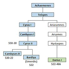
The Behistun Inscription (also Bisotun, Bisitun or Bisutun; Persian: بیستون, Old Persian: Bagastana, meaning "the place of god") is a multilingual Achaemenid royal inscription and large rock relief on a cliff at Mount Behistun in the Kermanshah Province of Iran, near the city of Kermanshah in western Iran, established by Darius the Great (r. 522–486 BC).
Later in the inscription, Darius provides a lengthy sequence of events following the death of Cambyses II in which he fought nineteen battles in a period of one year (ending in December 521 BC) to put down multiple rebellions throughout the Persian Empire.
The inscription states in detail that the rebellions were orchestrated by several impostors and their co-conspirators in various cities throughout the empire, each of whom falsely proclaimed himself king during the upheaval following Cambyses II's death.
[5] The inscription was illustrated by a life-sized bas-relief of Darius I, the Great, holding a bow as a sign of kingship, with his left foot on the chest of a figure lying supine before him.
The name Behistun is derived from usage in Ancient Greek and Arabic sources, particularly Diodorus Siculus and Ya'qubi, transliterated into English in the 19th century by Henry Rawlinson.
In 1598, Englishman Robert Sherley saw the inscription during a diplomatic mission to Safavid Persia on behalf of Austria, and brought it to the attention of Western European scholars.
[11] In 1835, Sir Henry Rawlinson, an officer of the British East India Company army assigned to the forces of the Shah of Iran, began studying the inscription in earnest.
[13] Later expeditions, in 1904 sponsored by the British Museum and led by Leonard William King and Reginald Campbell Thompson and in 1948 by George G. Cameron of the University of Michigan, obtained photographs, casts and more accurate transcriptions of the texts, including passages that were not copied by Rawlinson.
In 1938, the inscription became of interest to the Nazi German think tank Ahnenerbe, although research plans were cancelled due to the onset of World War II.
King Darius says: These are the countries which are subject unto me, and by the grace of Ahuramazda I became king of them: Persia [Pârsa], Elam [Ûvja], Babylonia [Bâbiruš], Assyria [Athurâ], Arabia [Arabâya], Egypt [Mudrâya], the countries by the Sea [Tyaiy Drayahyâ (Phoenicia)], Lydia [Sparda], the Greeks [Yauna (Ionia)], Media [Mâda], Armenia [Armina], Cappadocia [Katpatuka], Parthia [Parthava], Drangiana [Zraka], Aria [Haraiva], Chorasmia [Uvârazmîy], Bactria [Bâxtriš], Sogdia [Suguda], Gandhara [Gadâra], Scythia [Saka], Sattagydia [Thataguš], Arachosia [Harauvatiš] and Maka [Maka]; twenty-three lands in all.Later in the inscription, Darius provides an eye-witness account of battles he successfully fought over a one-year period to put down rebellions which had resulted from the deaths of Cyrus the Great, and his son Cambyses II: The site covers an area of 116 hectares.