Bernal Heights, San Francisco
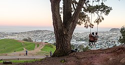
Its most prominent feature is the open parkland and radio tower on its large rocky hill, Bernal Heights Summit.
Built atop bedrock consisting largely of seismic-dampening radiolarian chert, many of the hill's structures had survived the tremor, and the sparseness of the development saved much of Bernal from the ravages of the firestorm that followed.
The commercial corridor of Eugenia Avenue filled in with shops as the pastureland on the hilltop was developed for workers' homes during the rapid rebuilding of the city.
Some of the tiny earthquake cottages,[9] which the city built to house quake refugees, survive to this day, including three that were moved up to Bernal Heights.
The new arrivals included many African-American families who worked at the nearby San Francisco Naval Shipyard at Hunters Point.
During the Vietnam War, the neighborhood was known as "Red Hill" for the anti-war activists in shared households and collectives who moved in among the working-class families.
[11] By the 1990s, Bernal's pleasant microclimate, small houses (some with traditional Victorian or Edwardian architecture) and freeway access to the peninsula and Silicon Valley led to a third wave of migration.
Bernal has not gentrified to the extent of its neighbor Noe Valley, but gentrification and property values are increasing as urban professionals replace working-class home owners and renters.
The local branch of the San Francisco Public Library at 500 Cortland was built by Frederick H. Meyer with funding from the Works Progress Administration and dedicated in 1940.
Bernal Heights Boulevard, which circles the hilltop, has about a 1-mile-long (1.6 km) path of asphalt and hard packed sand for walking and running that is closed to motor traffic.