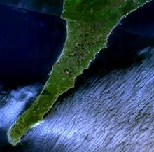
Cape Lopatka
Cape Lopatka also serves as the northernmost area of habitation by the Ainu people.
In 1737, Cape Lopatka's highest tsunami was recorded at 64 m (210 ft), washing over the peninsula,[1] triggered by a 9.0-9.3 MW earthquake.
In spite of its temperate latitude, the powerful Oyashio Current on the western flank of the Aleutian Low gives Lopatka a chilly and very wet polar climate that borders extremely closely on the subarctic (Köppen Dfc/ET), for which it just qualifies due to its 9.9 °C (49.8 °F) August means, which in low-lying areas would be expected only at latitudes about 20° or 2,200 kilometres (1,370 mi) further north.
Summers are mild but extraordinarily cloudy, with annual sunshine hours about 1,050 per year, which is comparable to Reykjavík or the extremely foggy Sichuan Basin.
Sunshine is actually most likely in the wettest months of September and October, when the heavy rain removes the low-level fog, but clear days are extremely rare at any time of year.