Carbon River
It flows about 30 miles (48 km) from its source, the Carbon Glacier on Mount Rainier, to join the Puyallup River at Orting.
Having run generally northwest, the Carbon River turns more directly west until it is joined by Evans Creek just before the small settlement of Fairfax.
It turns west, flowing through an increasingly broad floodplain to the town of Crocker, where the river is joined by one of its main tributaries, South Prairie Creek.
[5] Formed by glacial meltwater, the Carbon River contains a heavy load of sediment such as silt and gravel.
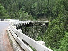
Between Fairfax and Carbonado the Carbon River flows through a narrow gorge (right) before emerging into another broad flood-prone valley near Crocker and Orting.
That added almost 11 miles (18 km) round trip for any hikes that formerly began at the Ipsut Creek Campground.
Flood and/or high water conditions continue to represent dangers to users and can occur with little warning.