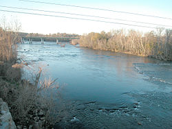
Congaree River
[1] It is formed in Columbia by the confluence of the Saluda and Broad rivers near the Piedmont Fall Line.
It serves as part of the boundary between Richland, Calhoun, and Lexington counties.
Despite the vast bottomland swamp below Columbia, the Congaree is navigable along much of its length at high water by barge traffic.
The 22,200-acre (90 km²) park contains some of the last remaining old growth bottomland hardwood forest in North America.
Recreational opportunities include hiking, biking, bird watching, botanical interests, and canoeing.