New York State Route 57
It extended for 33.45 miles (53.83 km) from an intersection with U.S. Route 11 (US 11) just north of downtown Syracuse to a junction with NY 104 six blocks from the Lake Ontario shoreline in Oswego.
The route largely paralleled NY 48, which follows the western bank of the waterway between Van Buren and Oswego via Baldwinsville.
Maintenance of NY 57 was split between the New York State Department of Transportation (NYSDOT) and the cities of Oswego and Syracuse.
[7] Outside of Liverpool, NY 57 headed generally northward past densely populated residential areas in the town of Clay.
Past John Glenn Boulevard, NY 57 took on a more pronounced northwesterly routing, matching the path of the Seneca River a short distance to the west and the CSX Fulton Subdivision to the east.
The route continued on, serving gradually less developed areas and turning northward as it approached and eventually crossed the Oneida River to enter Oswego County.
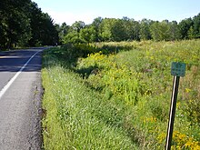
[7] Between Fulton and Oswego, the land surrounding the divided four-lane NY 57 was predominantly rural in nature, with few points of interest along the alignment.
In Seneca Hill, a hamlet located midway between Fulton and Oswego and across the river from Minetto, NY 57 met CR 45.
The route continued on a northwest track to Oswego, where NY 57 merged with an older alignment of itself south of the city and became East River Road.
Although NY 57 ended here, East 1st Street continued northward for a short distance to the Port of Oswego on Lake Ontario.