Cow Creek (Montana)
Cow Creek is a tributary of the Missouri River, approximately 35 miles (56 km) long, in north central Montana in the United States.
Cow Creek rises in the southern foothills of the Bear Paw Mountains in western Blaine County and flows east and then south, joining the Missouri approximately 25 air miles (40 km) northeast of Winifred, Montana—or 22 miles (35 km) upstream from the Fred Robinson Bridge.
[3] In May and June the Missouri River has "high water" from mountain snow melt, and steamboats who caught this flood could travel all the way through the breaks to reach the upriver terminus at Ft. Benton.
When "low water" came, deeper draft steamboats often could not reach Ft. Benton, and they had to drop their cargos downstream in the Missouri Breaks.
Over many millenniums, this greater seasonal discharge eroded and widened the creek bottom so it became flat enough for a team and wagon to traverse.
From the steamboat landing on the Missouri, the trail went north up the Cow Creek bottom for 15 miles (24 km) to Davidson Coulee, at which time the trail turned west and climbed up a long steep grade on Davidson Ridge to reach the plains north of the Missouri River Breaks.
From year to year, and month to month the volume of freight on the Cow Island Trail fluctuated depending on whether the riverboats had high water so they could get up river to Fort Benton, or whether low water over the Dauphine and other rapids caused riverboats to offload at Cow Island Landing.
By year end, 2,500 men, 3,000 teams and 20,000 oxen ere involved in freighting on the Cow Island Trail to Ft.
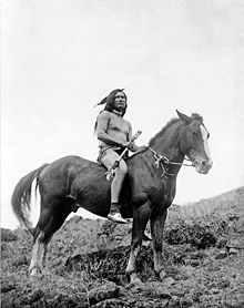
An army garrison of twelve men under Sergeant William Molchert was at Cow Island Landing, along with four civilian clerks who represented freighting interests in the region.
Fifty tons of freight, which had been offloaded from steamboats, lay under tarpaulins at the landing awaiting shipment by wagon to Fort Benton or other remote corners of the Montana Territory.
Upon the arrival of the Nez Perce, the soldiers and the clerks retreated into an earthen entrenchment which had been built around their tents to divert rain water.
[4] After crossing the river, the main body of the Nez Perce went past the soldiers without incident, and camped about two miles up Cow Creek.
The Indians and the soldiers exchanged sporadic gunfire through the night until about 10:00 in the morning, after which the Nez Perce moved off up Cow Creek.
On September 24 while still in Cow Island Canyon, the train was overtaken by the Nez Perce who approached them unthreateningly and camped one and one half miles away.
[4] On the morning of September 25, a small army relief force under Major Guido Igles approached the rear of the Nez Perce assemblage on Cow Creek.
[4] When the Nez Perce discovered Major Igles coming up Cow Creek, some warriors went down the canyon to take up positions to meet this threat.
The main body of the Nez Perce helped themselves to some goods in the wagons, set them on fire, and continued on up Cow Creek.
[4] Meanwhile, the Nez Perce warriors forming the rear guard had taken up positions on heights facing Major Igles small force which was down in Cow Creek canyon.
Fearing an ambush and knowing he was greatly outnumbered, Major Igles began a slow and cautious withdrawal to Cow Island Landing.
The capture of the Nez Perce occurred because they delayed in crossing the Canada–US border, allowing General Miles to catch up to them with a fresh force of soldiers, who were superior in number and firepower.
The events, "battles" and skirmishes on Cow Creek added to the overall delay, allowing General Miles to close the gap.
Where small creeks or streams emerge from the breaks to meet the Missouri, there are broad riverside "bottoms" with meadows and cottonwoods.
Here on Bull Creek bottom is another abandoned homestead with decaying and collapsing log buildings, and the debris from failed farming efforts.
This condition is recognized by the United States Bureau of Land Management (BLM), which is currently considering the lower portion of Cow Creek for wilderness status.
An unsupported (and very likely apocryphal) local rumor developed that the wagon train had been carrying gold and it was taken by the Nez Perce and buried in the vicinity.
A mostly dirt surfaced BLM road runs west from Montana Highway 66 for 14 miles (23 km), before dropping down into Bull Creek.
In the descent from the high ridges of the breaks into the Missouri bottom at Bull Creek, this road has steep rutted inclines and several switchbacks.
late this evening we passed a very bad rapid which reached quite across the river, [NB: water deep channel narrow gravel &c. on each side] the party had considerable difficulty in ascending it although they doubled their crews and used both the rope and the pole.
A Moby Dick of Ammonite fossils – one about 5 to 6 feet (1.5–1.8 m) across or larger – was identified by Shell Oil Company geologists engaged on a field survey in the Cow Creek area in the late 1950s.
Since it would take a crane to lift this monster, a heavy truck to haul it, and reasonably good roads to move it, this lost giant Ammonite fossil probably still awaits re-discovery on Cow Creek.