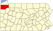
Cussewago Township, Crawford County, Pennsylvania
Unincorporated communities in the township include Crossingville in the northwest and Mosiertown in the south.
Interstate 79 crosses the eastern side of the township from north to south, but with no exits; the closest are Exit 154 (Pennsylvania Route 198), 2 miles (3 km) south of the southern border, and Exit 166 (U.S. Route 6N), two miles north of the northern border.
[4] Geologic Province:[5] Northwestern Glaciated Plateau Lowest Elevation:[6] 1,000 ft (300 m) where Cussewago Creek flows south out of the township.
Highest Elevation:[6] 1,551 ft (473 m) in the southeastern part of the township corner Major Rivers/Streams and Watersheds:[6] Cussewago Creek and French Creek Minor Rivers/Streams and Watersheds:[6] Lakes and Waterbodies:[6] Several impoundments in Cussewago Creek floodplain Biological Diversity Areas:[7] Carr Run BDA, Cussewago Creek Central Riparian Corridor BDA, Cussewago Creek at Crossingville BDA, and Pont Road Wetlands BDA Important Bird Area:[7] Cussewago Bottom and Erie National Wildlife Refuge Most of the township is wooded (56.8%), with agricultural use a distant second at 21.7%.
21.2% of all households were made up of individuals, and 8.5% had someone living alone who was 65 years of age or older.
