Cyclone Lehar
Moving along a generally west-northwestward path in the following days, the storm passed over an area having cooler waters and a moderate vertical wind shear.
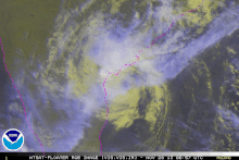
Lehar rapidly weakened to a Depression on 28 November and its fully exposed LLCC made its second landfall over the coast of Andhra Pradesh near Machilipatnam.
Extensive preparation was done in the wake of the storm by the authorities of the coastal districts of Andhra Pradesh and Odisha, including the evacuation of 45,000 people in low-lying areas.
On 19 November 2013 the Japan Meteorological Agency reported that a tropical depression had developed, about 365 km (225 mi) to the west of Kuala Lumpur, Malaysia.
The Joint Typhoon Warning Center (JTWC) issued a Tropical Cyclone Formation Alert (TCFA) on the system, assuming that it would intensify further as it moves into warmer sections of the Bay of Bengal.
[8] Being located in an area of moderate vertical wind shear of around 15 knots (28 km/h; 17 mph), convection gradually consolidated around the LLCC, though being slightly displaced towards the northwest.
[18] Though deep convection persisted along its well-define center, microwave imagery depicted drier air, restricting moist inflow along the southwestern periphery of the system.
[23] Four flights originating from Chennai bound to Port Blair were cancelled due to the cyclone on 25 November while 110 km/h (68 mph) winds hit the islands.
[26] Local state health officials were warned of a potential outbreak of diseases due to extremely heavy rainfall brought by the storm.
Because the storm rapidly weakened into a minimal depression before landfall, no fatalities or significant damage to property due to cyclone-related events were reported.
The director of the Bhubaneswar Meteorological Centre asked the ports of Paradip and Gopalpur to hoist danger signals in preparation for the storm.

Tropical storm (39–73 mph, 63–118 km/h)
Category 1 (74–95 mph, 119–153 km/h)
Category 2 (96–110 mph, 154–177 km/h)
Category 3 (111–129 mph, 178–208 km/h)
Category 4 (130–156 mph, 209–251 km/h)
Category 5 (≥157 mph, ≥252 km/h)
Unknown