Dent de Crolles
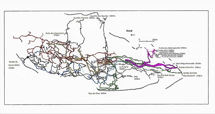
The Dent de Crolles (French pronunciation: [dɑ̃ də kʁol]) is a karstic mountain (2,062 m) of the Chartreuse Mountains range, 17 kilometres (11 miles) north east of Grenoble, Isère, France.
The mountain has a characteristic "tooth-like" profile; the French word dent means "tooth".
The Dent de Crolles is easily recognizable from the Isère Valley (Grésivaudan) near Grenoble.
It is easily recognizable from the Isère valley (Grésivaudan) in the Grenoble area.
Its first detailed exploration was during World War II by a small team of French cavers which included Pierre Chevalier, Fernand Petzl, and Charles Petit-Didier.