Dufferin Street
The street is named for Frederick Hamilton-Temple-Blackwood, 1st Marquess of Dufferin and Ava, who served as Governor General of Canada from 1872 to 1878.
Prior to 1878, the street was labelled as Western City Limits or Sideline Road south off Bloor.
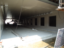
The 1911 bridge span across the railway north of the CNE grounds was determined to be unsafe for vehicular traffic in 2013, and was closed to vehicles.
[3] The City of Toronto plans to build a temporary bridge to restore vehicular traffic in advance of the replacement construction.
The west side is mostly single-family homes with one apartment building south of King Street.
From Bloor Street to Davenport Road, Dufferin is lined with homes built from the 1920s to post-World War II.
The neighbourhood west of Dufferin in this area is known as Wallace Emerson, while on the east it is known as Dovercourt Park.
Between Rogers Road and Eglinton Avenue West, Dufferin crosses two steep ravines.
At the time, the area north of the railway line was heavily industrial and factories backed onto the tracks.
This project was approved by city council in 2007, and work on extending the roadway began in July 2009.
[8] A further widening of the north side of the bridge was completed in 2016–2017 to support expanded GO Transit rail service.
By the 1960s, the Dufferin-St. Clair area (known as Corso Italia) had supplanted College-Grace Little Italy as the largest centre of Toronto's Italian community.
When the CNE is not operating, Dufferin buses continue south within Exhibition Place to Fleet Street where streetcar tracks carry the 509 Harbourfront and 511 Bathurst routes.
The YRT 105 only drops off southbound and picks up northbound from Steeles to Sheppard west station, because the TTC operates its 105 in that section.