Dumfriesshire
In terms of historic counties it borders Kirkcudbrightshire to the west, Ayrshire to the north-west, Lanarkshire, Peeblesshire and Selkirkshire to the north, and Roxburghshire to the east.
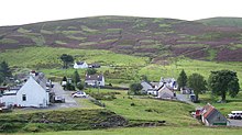
The county slopes very gradually from the mountainous districts of the Southern Uplands in the north, down to the sea; lofty hills alternating in parts with stretches of tableland or rich fertile holms.
[1] The Annan rises near the Devil's Beef Tub, a remarkable chasm in the far north, and after flowing about 40 miles (64 km), mainly in a southerly course, it enters the Solway at Barnkirk Headlands and bays.
[1] Between the Esk and Sark lies Scots' Dyke, a man-made berm that forms the Anglo-Scottish border, cutting through the area formerly known as the Debatable Lands.
[1] The greater portion of the county of Dumfries belongs to the Silurian tableland of the south of Scotland which contains representatives of all the divisions of that system from the Arenig to the Ludlow rocks.
[1] By far the largest area is occupied by strata of Tarannon and Llandovery age which cover a belt of country from 20 to 25 mi (32 to 40 km) across from Drumlanrig Castle in the north to Torthorwald in the south.
Consisting of massive grits, sometimes conglomeratic, greywackes, flags and shales, these beds are repeated by innumerable folds frequently inverted, striking northeast and southwest and usually dipping towards the northwest.
In the midst of this belt there are lenticular bands of older strata of Arenig, Llandeilo, Caradoc and Llandovery age composed of fine sediments such as cherts, black and grey shales, white clays and flags, which come to the surface along anticlinal folds and yield abundant graptolites characteristic of these divisions.
[1] These black shale bands are typically developed in Moffatdale; indeed the three typical sections chosen by Charles Lapworth to illustrate his three great groups: In the extreme northwest of the county between Drumlanrig Castle and Dalveen Pass in the south and the Spango and Kello Waters on the north, there is a broad development of Arenig, Liandeilo and Caradoc strata, represented by Radiolarian cherts, black shales, grits, conglomerates, greywackes and shales which rise from underneath the central Tarannon belt and are repeated by innumerable folds, in the cores of the arches of Arenig cherts there are diabase lavas, tuffs and agglomerates which are typically represented on Bail Hill east of Kirkconnel.
Along the southern margin of the Tarannon belt, the Wenlock and Ludlow rocks follow in normal order, the boundary between the two being defined by a line extending from the head of the Ewes Water in Eskdale, southwest by Lockerbie to Mouswald.
The Silurian tableland in the northwest of the county is pierced by intrusive igneous rocks in the form of dikes and bosses, which are regarded as of Lower Old Red Sandstone age.
In the Sanquhar basin the strata belong to the Coal Measures, and include several valuable coal-seams which are probably the southern prolongations of the members of this division in Ayrshire.
limit of the Sanquhar Coalfield there are patches of the Carboniferous Limestone series, but towards the N. these are overlapped by the Coal Measures which thus rest directly on the Silurian platform.
From a palaeontological point of view the Glencartholm volcanic zone is of special interest, as the calcareous shale associated with the tuffs has yielded a large number of new species of fishes, decapod crustaceans, phyllopods and scorpions.
In the tract along the Solway Firth they repose on the folded and eroded edges of the Carboniferous strata, and when traced westwards to the Dumfries basin they rest directly on the Silurian platform.
In the Thornhill basin there is a thin zone of volcanic rocks at the base of this series which are evidently on-the horizon of the lavas beneath the Mauchline sandstones in Ayrshire.
There are several striking examples of basalt dikes of Tertiary age, one having been traced from the Lead Hills south-east by Moffat, across Eskdalemuir to the English border.
From Dumfries westwards there were rail communications on the 'Port Road' to Castle Douglas, Newton Stewart, Stranraer and Portpatrick, with branches to Kirkcudbright and Wigtown all closed and lifted.
Until 1967 the North British Railway sent a short line to Langholm (via Canonbie and Gilnockie) from Riddings Junction in Cumberland, giving access to Carlisle.
The lands of the Selgovae were incorporated into the larger Brittonic-speaking kingdom of Strathclyde but over time came under pressure, by Gaels from Ireland, Angles from Northumbria and Vikings from Scandinavia.
The conquest of Dumfriesshire by Angles does not seem to have been thorough in the West, where Gaelic-speaking invaders held sway, the people of Nithsdale and elsewhere maintaining some Celtic institutions up to the time of David I, although this is not certain.
[1] Around 50 fragments of gilt bronze mounts found in Dumfriesshire and now at the National Museum of Scotland were probably originally attached to a portable wooden cross, c. 750 – c. 800AD.
The uplands of the shire afforded retreat to the persecuted Covenanters, who, at Sanquhar, published in 1680 their declaration against the king, anticipating the principles of the glorious Revolution by several years.
[1] Folk history suggests that at Holywood, near Dumfries, there stand the relic of the grove of sacred oaks from which the place derived its name, and a stone circle known locally as the Twelve Apostles.