GLONASS
GLONASS (ГЛОНАСС, IPA: [ɡɫɐˈnas]; Russian: Глобальная навигационная спутниковая система, romanized: Global'naya Navigatsionnaya Sputnikovaya Sistema, lit.
[1][2][3] Owing to its higher orbital inclination, GLONASS supplementation of GPS systems also improves positioning in high latitudes (near the poles).
Beginning on 12 October 1982, numerous rocket launches added satellites to the system until the completion of the constellation in 1995.
In 2001, after a decline in capacity during the late 1990s, the restoration of the system was made a government priority, and funding increased substantially.
[5] GLONASS is a global navigation satellite system, providing real time position and velocity determination for military and civilian users.
[7][8] GLONASS's orbit makes it especially suited for usage in high latitudes (north or south), where getting a GPS signal can be problematic.
The modulation (and therefore the tracking strategy) of the data bits on the L2SF code has recently changed from unmodulated to 250 bit/s burst at random intervals.
The message format of the high-precision signal remains unpublished, although attempts at reverse-engineering indicate that the superframe is composed of 72 frames, each containing 5 strings of 100 bits and taking 10 seconds to transmit, with total length of 36 000 bits or 720 seconds (12 minutes) for the whole navigational message.
The additional data are seemingly allocated to critical Lunisolar acceleration parameters and clock correction terms.
At peak efficiency, the standard-precision signal offers horizontal positioning accuracy within 5–10 metres, vertical positioning within 15 m (49 ft), a velocity vector measuring within 100 mm/s (3.9 in/s), and timing within 200 nanoseconds, all based on measurements from four first-generation satellites simultaneously;[12] newer satellites such as GLONASS-M improve on this.
GLONASS uses a coordinate datum named "PZ-90" (Earth Parameters 1990 – Parametry Zemli 1990), in which the precise location of the North Pole is given as an average of its position from 1990 to 1995.
Since 31 December 2013, version PZ-90.11 is being broadcast, which is aligned to the International Terrestrial Reference System and Frame 2008 at epoch 2011.0 at the centimetre level, but ideally a conversion to ITRF2008 should be done.
The open signal L3OC is centered at 1202.025 MHz and uses BPSK(10) modulation for both data and pilot channels; the ranging code transmits at 10.23 million chips per second, modulated onto the carrier frequency using QPSK with in-phase data and quadrature pilot.
[28] The strings have a version tag to facilitate forward compatibility: future upgrades to the message format will not break older equipment, which will continue to work by ignoring new data (as long as the constellation still transmits old string types), but up-to-date equipment will be able to use additional information from newer satellites.
[32] The new satellites will be deployed into three additional planes, bringing the total to six planes from the current three—aided by System for Differential Correction and Monitoring (SDCM), which is a GNSS augmentation system based on a network of ground-based control stations and communication satellites Luch 5A and Luch 5B.
[33][34] Six additional Glonass-V satellites, using Tundra orbit in three orbital planes, will be launched starting in 2025;[5] this regional high-orbit segment will offer increased regional availability and 25% improvement in precision over Eastern Hemisphere, similar to Japanese QZSS system and Beidou-1.
[35] The new satellites will form two ground traces with inclination of 64.8°, eccentricity of 0.072, period of 23.9 hours, and ascending node longitude of 60° and 120°.
Over the three decades of development, the satellite designs have gone through numerous improvements, and can be divided into three generations: the original GLONASS (since 1982), GLONASS-M (since 2003) and GLONASS-K (since 2011).
[36] The true first generation of GLONASS (also called Uragan) satellites were all three-axis stabilized vehicles, generally weighing 1,250 kg (2,760 lb) and were equipped with a modest propulsion system to permit relocation within the constellation.
The design life was three years, however numerous spacecraft exceeded this, with one late model lasting 68 months, nearly double.
These satellites possess a substantially increased lifetime of seven years and weigh slightly more at 1,480 kg (3,260 lb).
Laser corner-cube reflectors are also carried to aid in precise orbit determination and geodetic research.
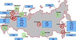
[7][8] The ground control segment of GLONASS is almost entirely located within former Soviet Union territory, except for several in Brazil and one in Nicaragua.
[51] As of 2011[update], some of the latest receivers in the Garmin eTrex line also support GLONASS (along with GPS).
[52] Garmin also produce a standalone Bluetooth receiver, the GLO for Aviation, which combines GPS, WAAS and GLONASS.
[53] Various smartphones from 2011 onwards have integrated GLONASS capability in addition to their pre-existing GPS receivers, with the intention of reducing signal acquisition periods by allowing the device to pick up more satellites than with a single-network receiver, including devices from: As of 17 February 2024[update], the GLONASS constellation status is:[61] The system requires 18 satellites for continuous navigation services covering all of Russia, and 24 satellites to provide services worldwide.
On 2 April 2014, the system experienced a technical failure that resulted in practical unavailability of the navigation signal for around 12 hours.
According to Russian System of Differentional Correction and Monitoring's data, as of 2010[update], precision of GLONASS navigation definitions (for p=0.95) for latitude and longitude were 4.46–7.38 m (14.6–24.2 ft) with mean number of navigation space vehicles (NSV) equals 7—8 (depending on station).
As of early 2012, sixteen positioning ground stations are under construction in Russia and in the Antarctic at the Bellingshausen and Novolazarevskaya bases.