Geodetic Facility for the Advancement of Geoscience
It focuses on research of Earth's surface deformation with enhanced temporal and spatial resolution—the field of geodesy.
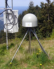
It operates and maintains the Network of the Americas (NOTA), supports researchers with access to instrumentation (including polar research projects such as POLENET), archives data, and provides education and workforce development resources.
The previous operator was UNAVCO, until its merger with the Incorporated Research Institutions for Seismology (IRIS) to become EarthScope Consortium.
It is composed of more than 1,200 continuously operating instruments, which include:[4] The network is used to measure ground motion related to tectonic plates, earthquakes, volcanoes, groundwater change, and other solid Earth processes, in addition to atmospheric measurements of water vapor and total electron content in the ionosphere.
[5][6] The IGS network is used to produce the International Terrestrial Reference Frame (ITRF) for positioning, satellite navigation and Earth science applications.