Geography of Palau
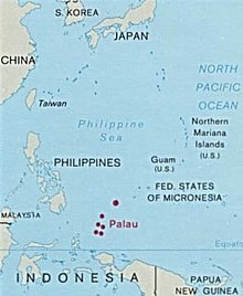
The Republic of Palau consists of eight principal islands and more than 250 smaller ones lying roughly 500 miles southeast of the Philippines, in Oceania.
The Palau archipelago contains more than 250 islands and islets stretched along a 150 km north south trending arc in the western Pacific.
The geologically diverse archipelago is dominated by Babeldaob, primarily a volcanic island, whose 363 km2 area represents more than three fourths of Palau's total land mass.
Weathered material from exposed upper parts of the volcanic islands was eroded away and accumulated in shallow coastal waters forming deposits of clay.
The limestone is raised coralline reef structure which formed in the warm tropical waters during Miocene to Pleistocene times.
Surrounding the volcanic islands are natural terraced benches resulting from sea level changes and uplifting of the Palau ridge.
Geologic data indicate that Babeldaob Island has undergone a net uplift of land relative to sea level of about 2 m in the last 4000 years; thus, for most of the Palau coastline, submerged habitation sites in intertidal and coastal swamp areas are unlikely.
Excepting a few calcareous sand beaches, the rock island edges rise abruptly out of the water, forming steep cliffs.
The constant heating of the ocean surface in the tropics creates a highly-stratified temperature regime in the water column, with little mixing.
This general regime may vary locally or seasonally, as in the case of the upwelling of cold subsurface waters along steep leeward islands slopes.
Limestone island soils may be either level, deep and sandy or steep, shallow and loamy in areas where they are associated with rock outcrops.
[1] Maritime claims: territorial sea: 12 nautical miles exclusive economic zone: 603,978 km2 (233,197 sq mi) (200 nmi) Elevation extremes: lowest point: Pacific Ocean 0 m highest point: Mount Ngerchelchauus 242 meters (794 ft) (on Babeldaob) Land use: arable land: 2.17% permanent crops: 4.35% other: 93.48% (2011) Environment - international agreements: party to: Biodiversity, Climate Change, Climate Change-Kyoto Protocol, Desertification, Law of the Sea [1] Terrain varies geologically from the high, mountainous main island of Babeldaob to low, coral islands usually fringed by large barrier reefs.
Current environmental issues include inadequate facilities for disposal of solid waste; threats to the marine ecosystem from sand and coral dredging, illegal fishing practices, and overfishing.
The northeast trade winds, usually blowing from December to July bring frequent rains and often a slightly drier time from February through April.
An extensive barrier reef surrounds the central islands of the archipelago, forming a rich lagoon area of more than 1200 sq.
At present, only 75% of the Palau Islands are forested, the rest being covered by secondary vegetation, marsh, grassland, crop land, urban development, or are barren.
The important resources of the food producing forest associations include coconut, breadfruit, mango, banana, almond, and betelnut.
This article incorporates text from this source, which is in the public domain: A preliminary wildlife management plan for the Republic of Palau vertebrates