Geography of Scotland in the early modern era
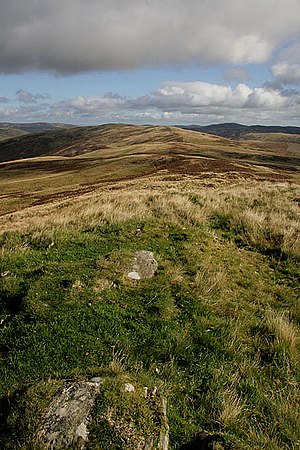
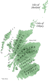
The defining factor in the geography of Scotland is the distinction between the Highlands and Islands in the north and west and the Lowlands in the south and east.
The Uplands and Highlands had a relatively short growing season, exacerbated by the Little Ice Age, which peaked towards the end of the seventeenth century.
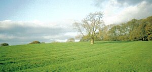
There was an attempt improve agriculture, resulting in new crops, techniques and enclosures began to displace the run rig system and free pasture.
Compared with the situation after the redistribution of population as a result of the clearances and the Industrial Revolution that began in the eighteenth century, these numbers were more evenly spread over the kingdom, with roughly half north of the River Tay.
By the early modern era Gaelic had been in geographical decline for three centuries and had begun to be a second class language, confined to the Highlands and Islands.
From the mid sixteenth century, written Scots was increasingly influenced by the developing Standard English of Southern England, which came to dominate elite discourse.
The extent and borders of the kingdom had been fixed in their modern form by the beginning of the sixteenth century, with the exception of the debatable lands, settled by a French led commission in 1552.
The accession of James VI to the English throne made the borders less significant in military terms, becoming, in his phrase the "middle shires" of Great Britain, but it remained a jurisdictional and tariff boundary until the Act of Union in 1707.
[1] The Central Lowland belt averages about 50 miles in width[2] and, because it contains most of the good quality agricultural land and has easier communications, could support most of the urbanisation and elements of conventional government.
The early modern era also saw the impact of the Little Ice Age, of worldwide colder and wetter weather, which peaked towards the end of the seventeenth century.
[7] In the Highlands and Galloway in the early eighteenth century, a series of military roads were built and maintained by the central government, with the aim of facilitating the movement of troops in the event of rebellion.
Turnips and cabbages were introduced, lands enclosed and marshes drained, lime was put down, roads built and woods planted.
However, although some estate holders improved the quality of life of their displaced workers, enclosures led to unemployment and forced migrations to the burghs or abroad.
Estimates based on English records suggest that by the end of the Middle Ages the Black Death and subsequent recurring outbreaks of the plague may have caused the population of Scotland to fall as low as half a million people.
The first reliable information available on national population is from the census conducted by the Reverend Alexander Webster in 1755, which showed the inhabitants of Scotland as 1,265,380 persons.
[18] One result of the Little Ice Age was the abandonment of marginal land in the early part of the period, as it became impossible to sustain agriculture in some regions, particularly in the uplands, but new settlements were created as a result of the opening up of hunting reserves like Ettrick Forest and less desirable low-lying land was also settled, often incorporating features into their names such as bog, marsh and muir.
[22] By the early modern era Gaelic had been in geographical decline for three centuries and had begun to be a second class language, confined to the Highlands and Islands.
[29] The Society in Scotland for Propagating Christian Knowledge (SSPCK), established in 1709, aimed to teach English language and end the attachment to Roman Catholicism associated with rebellious Jacobitism.
[36] The exception, the debatable lands at the western end of the border with England, were settled by a French led commission in 1552 and the Scots' Dike built to mark the boundary.
[37] The accession of James VI to the English throne made the border less significant in military terms, becoming, in his phrase, the "middle shires" of Great Britain.
In 1605, he established a single commission of ten men drawn from equally Scotland and England to bring law and order to the region, but lawlessness continued and it remained a jurisdictional and tariff boundary until the Act of Union in 1707.
[39] It was the wealthiest and largest city in the kingdom and held the central law courts, parliament and royal residence at Holyrood Palace.
In the last quarter of the sixteenth century, Timothy Pont created a series of sketch maps of Scotland and recorded the names and details of 20,000 places he visited or noted.