Geology of Lancashire
The geology of Lancashire in northwest England consists in the main of Carboniferous age rocks but with Triassic sandstones and mudstones at or near the surface of the lowlands bordering the Irish Sea though these are largely obscured by Quaternary deposits.
The southern part of the Forest of Bowland, including the prominent Parlick together with the isolated Beacon Fell are also formed from the Pendle Grit.
Warton Crag and Jack Scout, a National Trust property, are prominent features in the locality where the limestone is well exposed.
Leck Fell is an area of limestone moorland west of the hill of Gragareth, the county's highest point, close to the border with both North Yorkshire and Cumbria.
[4] A small area of rocks originating in the Permian Period occurs near Lancaster, Morecambe and Glasson Dock though it is entirely obscured by recent deposits and is known only from borehole cores.
There are also narrow bands of these rocks (Manchester Marls and Collyhurst Sandstone) to the north and south of Preston though again they are generally buried beneath glacial till.
Another small outlier of early/lower Permian rocks is centred on the village of Ireby and extends across the county boundary into North Yorkshire.
Lancashire's coastal plain is underlain by sedimentary rocks laid down during the Triassic Period comprising sandstones, siltstones and mudstones though outcrops are restricted to those areas which are not covered by thick superficial deposits.
Within the Kirkham basin, the following Triassic sequence is known from boreholes: The lowermost part of the Sherwood Sandstone Group is of Permian age.
Its alignment is roughly similar to that of numerous faults in the area and is seen to vary in width from over 5m to just 60 cm across its three known exposures.
The area is threaded by numerous broadly north-south aligned normal faults thought to have been active during Permo-Triassic times and perhaps later, in association with early rifting of the Atlantic Ocean.
These deposits are the legacy of the over-riding of the area on several occasions by glacial ice during the past 2 million years.
The present distribution of deposits and the landforms to which they give rise are largely the result of the last ice age, the Devensian which peaked around 22-20,000 years ago.
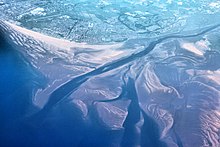
[10] Extensive areas of blown sand have been mapped along the coastal zone south from Blackpool through Lytham St Annes.
Narrower belts of these deposits also characterise the north coast of Fylde at Fleetwood and Preesall and a rather smaller area west of Sunderland Point.
A study in the Forest of Rossendale by the British Geological Survey revealed three main types of occurrence, namely those associated with: They range from rotational ones, often multiple in nature to simple topples and rock falls.