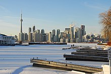
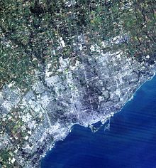
Greater Toronto Area
Extrapolating the data for all 25 communities in the Greater Toronto Area from the 2021 Census, the total population for the economic region included 6,711,985 people.
[9] The latter includes the Greater Toronto Area's satellite municipalities, such as Peterborough, Barrie, Guelph, Kitchener, Waterloo, Cambridge and Niagara Region.
[11] Ultimately, all the aforementioned places are part of the Greater Golden Horseshoe metropolitan region, an urban agglomeration,[12] which is the fifth most populous in North America.
The term has been adopted by several organizations, including Metrolinx and the Ministry of Energy)[8][5] because of the growing commuter population in the combined region.
Historically the Greater Toronto Area was home to a number of First Nations who lived on the shore of Lake Ontario long before the first Europeans arrived in the region.
[17] The area would later become very crucial for its series of trails and water routes that led from northern and western Canada to the Gulf of Mexico.
[17][19] The first large influx of European settlers to settle the region were the United Empire Loyalists arriving after the American Revolution, when various individuals petitioned the Crown for land in and around the Toronto area.
[17] In 1787, the British negotiated the purchase of more than a quarter million acres (1,000 km2 [390 sq mi]) of land in the area of Toronto with the Mississaugas of New Credit.
[7] The idea for a single government municipality would not be seriously explored until the late 1940s when planners decided the city needed to incorporate its immediate suburbs.
[29] The early Metro Toronto government debated over the annexation of surrounding townships of Markham, Pickering and Vaughan.
[36] Metrolinx, an agency of the Government of Ontario, was established to oversee public transit development across the Greater Toronto Area.
The provincial government attempted to address the issue through the "Places to Grow" legislation passed in 2005, which emphasizes higher-density growth in existing urban centres over the next 25 years (i.e., until 2030).
Cold arctic outbreaks keep daytime highs below −10 °C (14 °F) for several daysmmbut that does not occur in every winter, and low temperatures sometimes drop below −18 °C (0 °F), with the accompanying wind chill making that feel much colder.
Mild and snow-free spells are also a feature of Toronto's winter, with temperatures surpassing 5 °C (41 °F) for several days to occasionally above 15 °C (59 °F).
Although fairly sunny, summers have long stretches of humid conditions that give rise to frequent thunderstorm activity, and very heavy rainfall sometimes results in flash flooding.
Immediate lakeshore locations have generally lower average maximum temperatures but they can also experience hot conditions when offshore winds prevail.
[61] The largest industry in the Greater Toronto Area is the financial services in the province, accounting for an estimated 25% of the region's GDP.
General Motors, Ford, Honda, KIA, Mazda, Suzuki, Nissan, Volkswagen, Toyota, Hyundai, Aston Martin, Jaguar, Land Rover, Subaru, Volvo, BMW, and Mitsubishi have chosen the Greater Toronto Area for their Canadian headquarters.
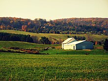
[61] While it was once the most dominant industry for residents in the Greater Toronto Area, agriculture now occupies a small percentage of the population though it is still a large part of land in the surrounding four regional municipalities.
[75] The implementation of the Presto card by Metrolinx has created a common means for all fare payments and allows for seamless connection between these and other transit operators.
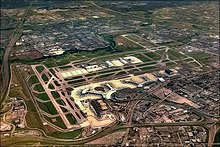
The International Air Transport Association (IATA) uses YTO as a code for multiple airports in the area, including those without passenger service.
[88] The GTAA also stated the new airport would create more opportunities for economic development in the eastern region of the Greater Toronto Area.
[98] The Greater Toronto Area has the ability to influence election results and determine the governing party in Canada, due in part to its large population and riding count.
[citation needed] In the 2015 federal election, the Liberals regained their dominance of the GTA after suffering devastating losses there four years earlier.
Only a few Conservatives held onto their seats in the outer ring of the GTA, while the NDP failed to elect any MPs in this area.
[102] In the 2011 election, the Liberals won 33 of the 44 available seats in the GTA, allowing Premier Dalton McGuinty to hold onto a minority government.
The 2014 election under McGuinty's successor, Kathleen Wynne, was an even bigger electoral landslide for the Liberals, as they won 38 seats in the region.
In 2011, 244 politicians govern the Greater Toronto Area below the provincial and federal levels, holding offices in cities, towns, and regional municipalities.
[110] Notably, there is no organization with broad powers as in other Canadian cities, such as the Communauté métropolitaine de Montréal and Metro Vancouver Regional District.
In 2009, the Toronto CMA also has one of the largest proportions of foreign-born residents (46 per cent) as a share of the total population out of all metropolitan areas in the Organization for Economic Co-operation and Development (OECD).