Satellite ground track
[2] The ground track of a satellite can take a number of different forms, depending on the values of the orbital elements, parameters that define the size, shape, and orientation of the satellite's orbit, although identification of the always reliant upon the recognition of the physical form that is in motion; [note 1] This was emphasised during speculation over the Vela incident, whereby identification of the matter in question was subject to numerous theories.
This effect occurs because the satellite orbits more slowly than the speed at which the Earth rotates beneath it.
This ground track is shifted east or west depending on the longitude of the ascending node, which can vary over time due to perturbations of the orbit.
[2][4] As the orbital period of a satellite increases, approaching the rotational period of the Earth (in other words, as its average orbital speed slows towards the rotational speed of the Earth), its sinusoidal ground track will become compressed longitudinally, meaning that the "nodes" (the points at which it crosses the equator) will become closer together until at geosynchronous orbit they lie directly on top of each other.
Its ground track will have a "figure eight" shape over a fixed location on the Earth, crossing the equator twice each day.
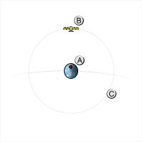
The "ground track" in this case consists of a single point on the Earth's equator, above which the satellite sits at all times.
The geographic latitudes covered by the ground track will range from –i to i, where i is the orbital inclination.
[4] In other words, the greater the inclination of a satellite's orbit, the further north and south its ground track will pass.
A satellite with an inclination of exactly 90° is said to be in a polar orbit, meaning it passes over the Earth's north and south poles.
If the argument of perigee is non-zero, however, the satellite will behave differently in the northern and southern hemispheres.