Herzogenhorn
The two mountain ridges radiating from the Herzogenhorn, south towards St. Blasien and west via the Bernauer Kreuz to Hasenhorn near Todtnau are popular hiking areas.
From the Herzogenhorn, as well as the Feldberg to the north and Belchen to the west, there is a panoramic view in fine weather of the chain of the Alps from the Zugspitze to the southeast to Mont Blanc to the southwest.
The mountain is already mentioned in a 1328 scroll as "des herzogen horne" as a point on the boundary of the abbey of St. Blaise[3] The first primitive fortifications probably date to the time around the Thirty Years' War, whilst the construction of the fortification line of schanzen on the mountain is attributed to Margrave Louis William, "Turkish Louis".
[5] The Herzogenhorn inn was bought in 1957 from the Black Forest Ski Club, was converted and then opened on 22 October 1967 as the new National Training Centre.
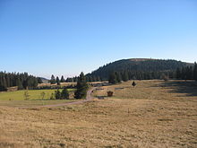
The routes starting at the National Training Centre (about 15–20 km, depending on snow conditions) lead in tight loops across the hilly plateau between the Herzogenhorn, Grafenmatt and Silberberg and are the highest loipen in the Black Forest (approx 1,350 m).